Loading content...
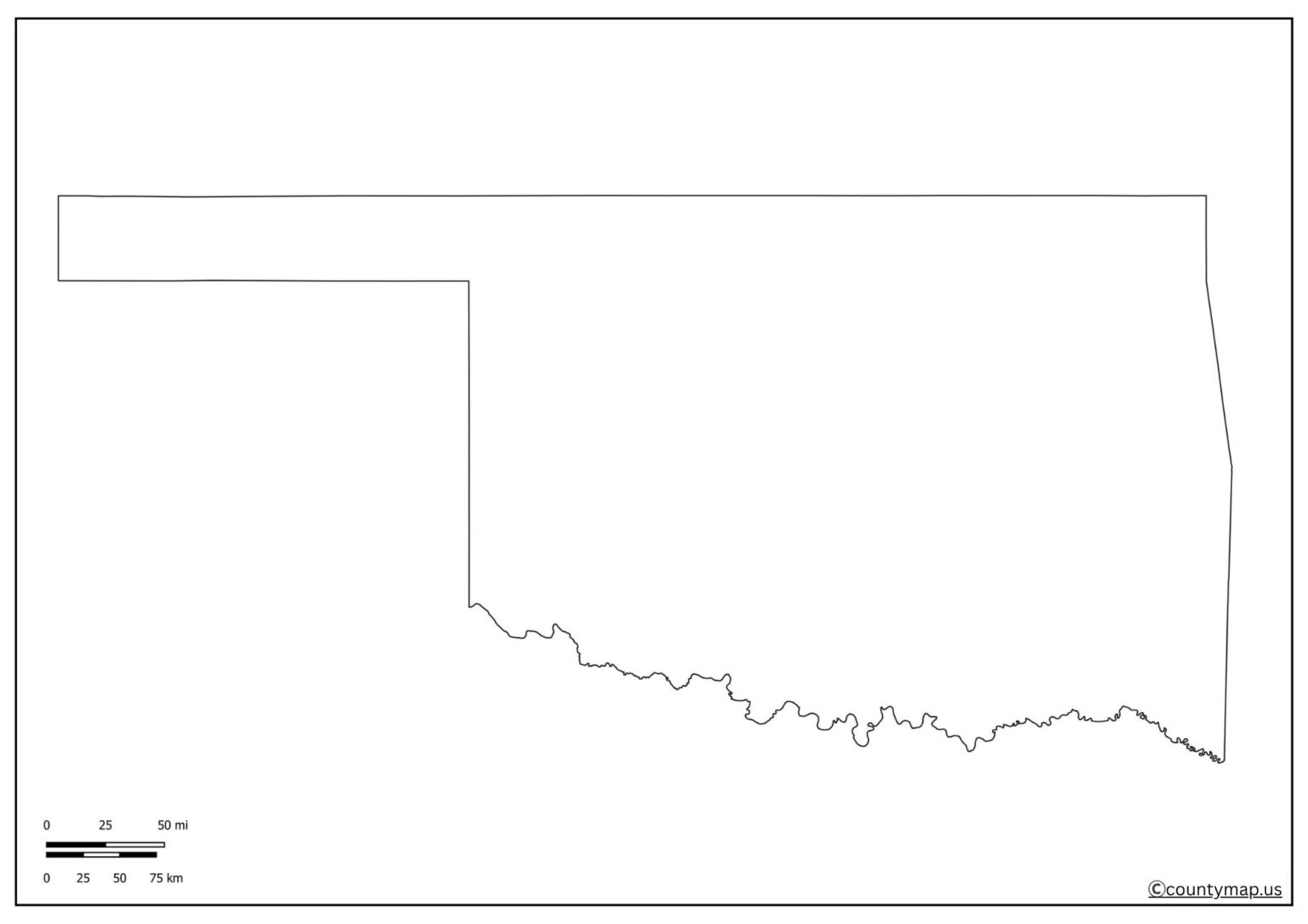
Blank Oklahoma Map | Printable OK Map PDF
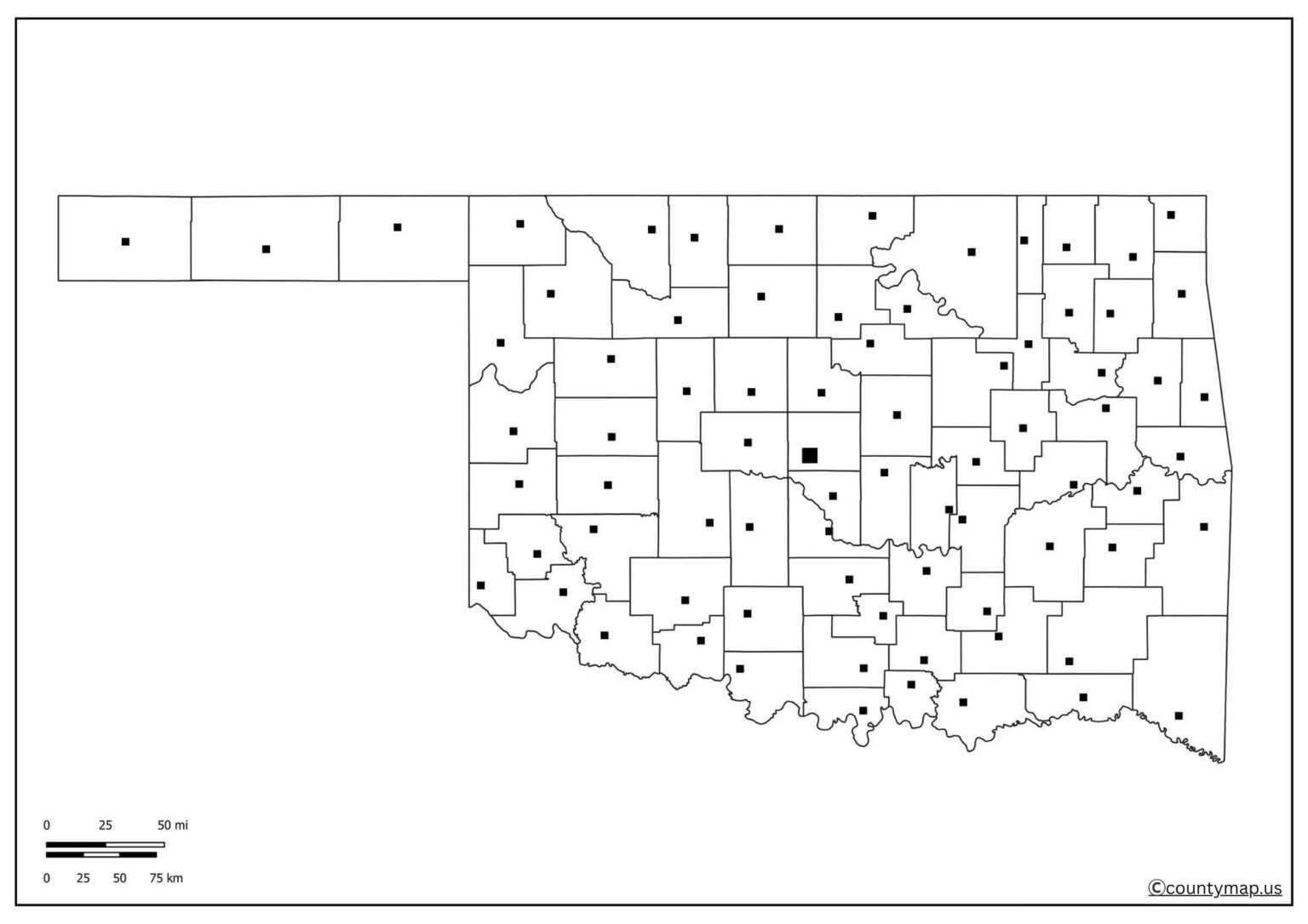
The blank Oklahoma map is a valuable tool for students, educators, researchers, and even traveling people who need to be able to explore the geography of the state without labels. Oklahoma is in the South-Central part of the United States, and it is a diversified area in terms of its landscape; there are plains, forests, and hills. With a blank map of Oklahoma, users can customize the contents depending on their needs, be it for educational, research, or traveling purposes.
A blank map can be used to assess the knowledge of students in terms of the counties, cities, rivers, and landmarks of Oklahoma. It promotes participatory learning, where the students are left to fill in the geographical details themselves. Users are able to map the routes, tourist sites, and highways, making it easier to plan their trips. The map enables researchers and historians to display demographic or historical information in a clear way.
Free Printable Blank Oklahoma Map
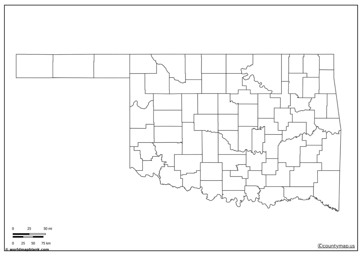
A blank map has the flexibility and adaptability for many different tasks as opposed to detailed political or physical maps. Its ease of use is its most helpful quality, and it can be applied to both academic and professional use. You can use a blank map, whether you are doing a classroom assignment, a presentation, or just need to learn more about Oklahoma.
| Rank | City | Population (2025) | Area (sq mi) | County(s) |
| 1 | Oklahoma City | 712,919 | 621 | Oklahoma |
| 2 | Tulsa | 415,154 | 198 | Tulsa |
| 3 | Norman | 131,010 | 179 | Cleveland |
| 4 | Broken Arrow | 122,756 | 63 | Tulsa |
| 5 | Edmond | 99,040 | 84 | Oklahoma |
| 6 | Lawton | 90,027 | 81 | Comanche |
| 7 | Moore | 63,845 | 22 | Cleveland |
| 8 | Midwest City | 58,505 | 24 | Oklahoma |
| 9 | Enid | 50,519 | 50 | Garfield |
| 10 | Stillwater | 50,138 | 30 | Payne |
| 11 | Owasso | 42,821 | 22 | Tulsa |
| 12 | Bartlesville | 38,355 | 22 | Washington |
| 13 | Muskogee | 36,849 | 28 | Muskogee |
| 14 | Shawnee | 32,092 | 25 | Pottawatomie |
| 15 | Bixby | 31,728 | 18 | Tulsa |
| 16 | Jenks | 27,869 | 17 | Tulsa |
| 17 | Yukon | 27,068 | 29 | Canadian |
| 18 | Ardmore | 24,813 | 20 | Carter |
| 19 | Ponca City | 24,232 | 20 | Kay |
| 20 | Duncan | 22,544 | 20 | Stephens |
| 21 | Sapulpa | 22,205 | 22 | Creek |
| 22 | Del City | 21,920 | 10 | Oklahoma |
| 23 | Bethany | 21,187 | 5 | Oklahoma |
| 24 | Mustang | 20,375 | 8 | Canadian |
Uses of the K Map Outline PDF
Student and Teacher Educational Resource.
- A blank Oklahoma map has been used most often in education.
- In classrooms, teachers usually give such maps to students to train their skills in recognizing countries, boundaries between states, rivers, and major cities.
- Students can label significant characteristics, color-code various areas, and indicate natural resources.
- Such practical exercise reinforces them in geography and aids memorization.
For Travellers and Tourists
- The map can be used in the form of a blank map, allowing travelers to draw routes and mark destinations when they plan a road trip or a tour in Oklahoma.
- Popular cities such as Oklahoma City, Tulsa, and Norman may be mentioned, and the tourist attractions, Route 66, Wichita Mountains, and state parks should be mentioned.
- Blank map flexibility gives travelers the freedom to tailor their trip and the ability to track the places visited.
Research and Analysis
- Blank maps are frequently used to display data in the works of researchers who work in various disciplines, including history, demographics, or environmental studies.
- Researchers can also make their work easier to understand and to visualize with the addition of such information as the population distribution, climate patterns, or historical events.
- The map is used as a screen to trade elaborate findings in a streamlined fashion.
Business and Marketing Applications.
- Blank maps can be used in logistics, distribution, and market analysis planning by businesses that are located in Oklahoma.
- Companies can indicate sales areas, warehouses, or delivery tracks.
- The map may also be used in presentations by marketing experts so that the business coverage area and growth strategies are demonstrated clearly and professionally.
Projects and Presentations Customization.
- Blank Oklahoma maps are perfect to use in creative work and presentations.
- They can be used as assignments for the students or in reports or slides by the professionals.
- Because the map is not labelled, the user can highlight only the data, which suits his or her specific project.
- This renders the map an adaptable and reusable tool.
To Researchers and Historians.
- Blank mallow historiansnity to mark important events, battles, or migration trends in the history of Oklahoma.
- This gives a pictorial explanation of the way the state evolved with time.
- Blank maps are also helpful to researchers who study the heritage of Native Americans in Oklahoma because they can be used to depict the areas of tribal settlement and cultural locations.
Conclusion
A blank Oklahoma map is not only a plain outline; it is a potent resource and can be modified for various teaching, researching, and professional purposes. It is flexible, which means that a student can study geography actively, a traveler can plan the routes efficiently, and a researcher can display data effectively. There are also business and professional benefits; maps can be customized for use in logistics and analysis. A blank Oklahoma map offers a flexible base, whether it is to complete an academic task, conduct historical research, or plan a trip. Its capacity to be customized to suit various functions makes it a useful resource to anybody who wishes to explore and learn about Oklahoma.


