Loading content...
Blank Virginia Map | Printable VA Map PDF

A Blank Virginia Map is a valuable resource to students, educators, researchers, travellers, and professionals who wish to explore or analyse the state in a more detailed and personalised manner. Virginia is a state on the East Coast of the United States, which has a rich history, a varied geography and cultural importance. The Atlantic Ocean, West Virginia, Kentucky, Maryland, Tennessee, and North Carolina are along its borders, and it is in the middle of both its geography and history.
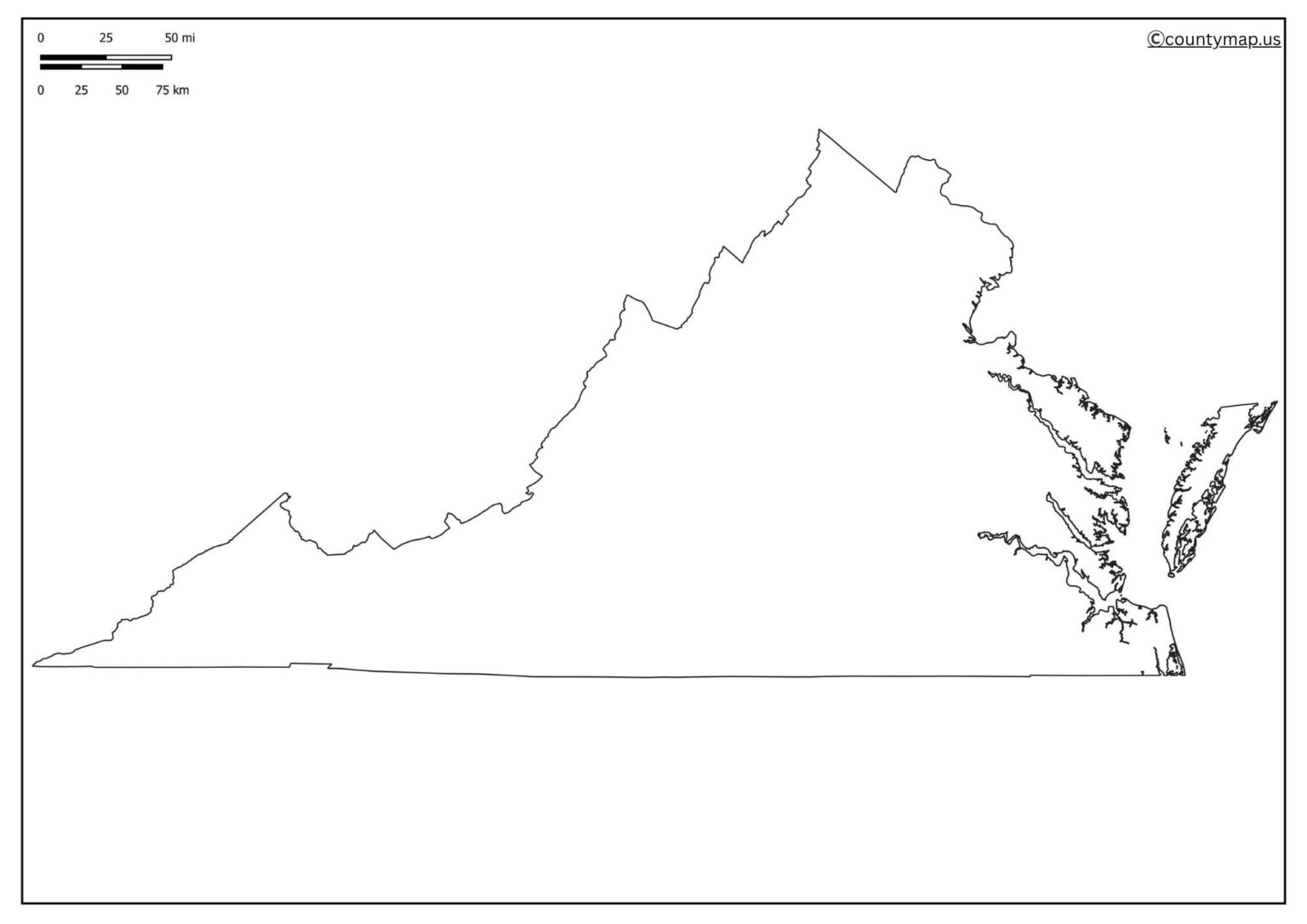
Blank maps of Virginia offer a neat map of Virginia without any labels or markers, and therefore, the users are free to add the required information. Be it counties, cities, rivers, mountain ranges, or highways, a blank map can be customised to meet individual needs.
Free Printable Blank Virginia Map
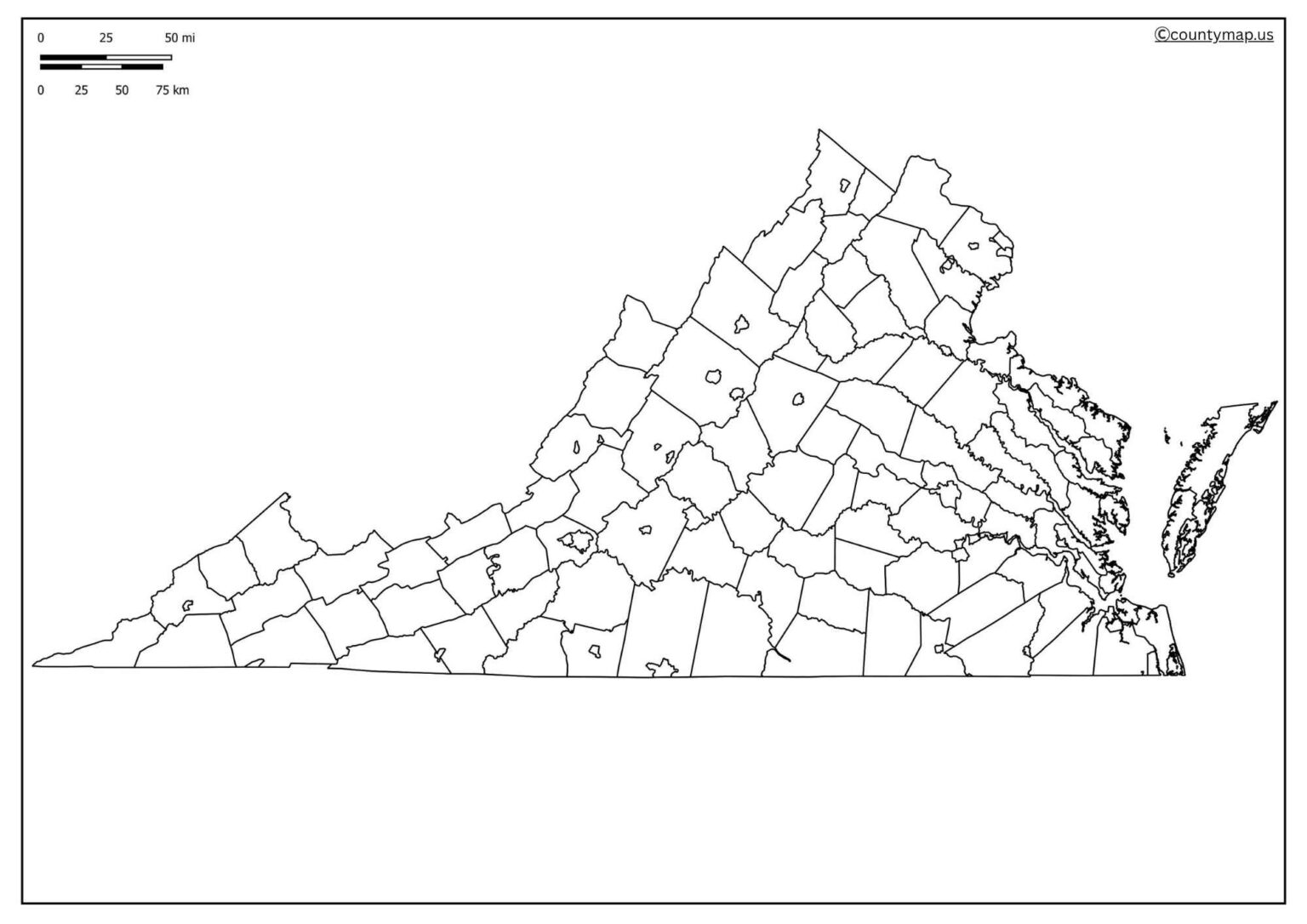
These maps are also frequently used by teachers in classroom activities so that students can learn the significant locations and geographic features. They are used by researchers and historians to visually represent their data, and by travellers to arrange tours within the state across the most popular sites, like Shenandoah National Park, Virginia Beach, or Colonial Williamsburg.
| Rank | City | Population (2025) | Area (sq mi) | County |
| 1 | Virginia Beach | 459,470 | 249 | Independent |
| 2 | Chesapeake | 253,886 | 338 | Independent |
| 3 | Arlington | 234,162 | 26 | Independent |
| 4 | Norfolk | 230,930 | 54 | Independent |
| 5 | Richmond | 229,247 | 60 | Independent |
| 6 | Newport News | 183,118 | 69 | Independent |
| 7 | Alexandria | 155,230 | 15 | Independent |
| 8 | Hampton | 137,098 | 51 | Independent |
| 9 | Suffolk | 100,659 | 399 | Independent |
| 10 | Roanoke | 99,634 | 43 | Independent |
| 11 | Portsmouth | 96,700 | 95 | Independent |
| 12 | Lynchburg | 82,000 | 49 | Independent |
| 13 | Danville | 42,000 | 43 | Independent |
| 14 | Manassas | 42,000 | 10 | Independent |
| 15 | Harrisonburg | 54,000 | 17 | Independent |
| 16 | Leesburg | 53,000 | 12 | Loudoun |
| 17 | Blacksburg | 44,000 | 16 | Montgomery |
| 18 | Winchester | 28,000 | 9 | Independent |
| 19 | Staunton | 24,000 | 19 | Independent |
| 20 | Waynesboro | 22,000 | 15 | Independent |
Uses of Blank Virginia VA Map Outline PDF
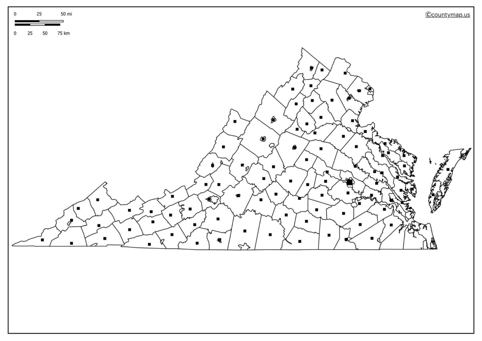
Blank Virginia Map is easily applicable in several different areas of education, research, planning, and creativity because of its simplicity and ease of use.
Educational Purposes
- The Blank Virginia Map is also popular, ie schools and colleges where geography and history are studied.
- The students will be able to label the counties, state boundaries, rivers, the cities to enhance what they know.
- They are also used by teachers as tests, quizzes and assignments.
- The maps facilitate active learning as they enable a student to interact with the material as opposed to memorising facts.
Travel Planning
- Blank maps are useful in planning trips by tourists and other travellers.
- The state has various attractions, such as the Blue Ridge Mountains and Virginia Beach, among others.
- Users have an option of labelling roads, pathways and destinations to form a custom map.
- It becomes easier to visualise their journey, and this is because nothing important is overlooked.
Research and Analysis
- Historical, political, and demographic studies are done using blank maps.
- An empty map can be used to display information such as population density, weather patterns, farmland or election outcomes.
- When the map is customised, analysts can present complex information visually and clearly.
Business and Logistics
- Blank Virginia maps are frequently used by companies and logistics planners to indicate areas of delivery, warehouse or service areas.
- These visual tools are helpful to businesses in case of making expansions or controlling distribution networks within the state.
Community and Government Planning.
- Blank maps are utilised by government agencies and community organisations in managing disasters, planning the services to be distributed to the community and also marking key facilities such as hospitals and schools.
- They can also be used in awareness campaigns, such as asflood-sensitivee or road safety areas.
Imaginative and Individual projects.
- The blank maps are great to use in colouring-in activities, student projects, and artwork.
- They can be made by hobbyists into ornamental focusing wall maps, and by genealogists and historians to represent family migrations or historical events.
- Their flexibility also makes them a source outside of academics and professional activities.
Tourism Promotion
- Blank Virginia maps can be utilised by the tourism boards as brochures, travel guides, as well as in promoting events.
- Maps that are customised aid in highlighting attractions and routes, hence they are very effective in communication.
Conclusion
Blank Virginia Map is not merely a simple sketch of the state;e, it is a versatile tool that can be used by educators and researchers, people travelling the state, companies, and governmental agencies alike. Its format can be customised, e, and thus it can be used in planning, studyinanalysinging or even creating art. Blank maps of Virginia, even with their free printable and online editions, are still useful as long as one wants to explore, learn, or visualise something. Be it in the classrooms, offices, or for personal use, the Blank Virginia Map is a viable and valuable asset in many uses.