Loading content...
Blank South Carolina Map | Printable SC Map PDF
A Blank South Carolina Map is a multi-purpose and indispensable resource of information on the state, which allows teachers, learners, scholars, tourists, and business people to obtain a clear view of the state without any labels that imply specific facts. The state of South Carolina, which is in the southeast of the United States, is characterised by its very rich history, scenic beauty, and culture. Blank maps are the best maps to understand and analyse the state because of the diverse geographic features it has been able to offer as a result from the Atlantic coastline to the Blue Ridge Mountains.
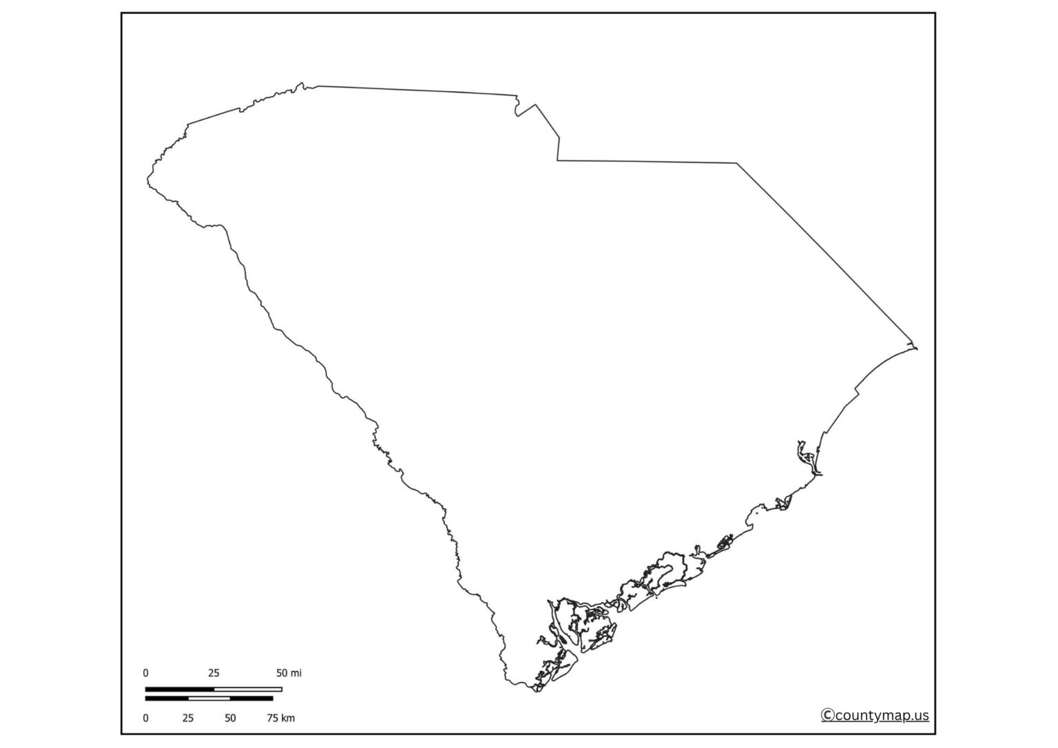
South Carolina blank maps give users the option to add their own content in the form of counties, cities, rivers, highways, and landmarks, which makes them very customizable towards various applications. These maps are used by teachers and students in their classrooms to study geography, historical events, and map labelling exercises. Blank maps can be used by researchers and analysts to display a graphical representation of demographic statistics, voting, or environmental research.
Free Printable Blank South Carolina Map
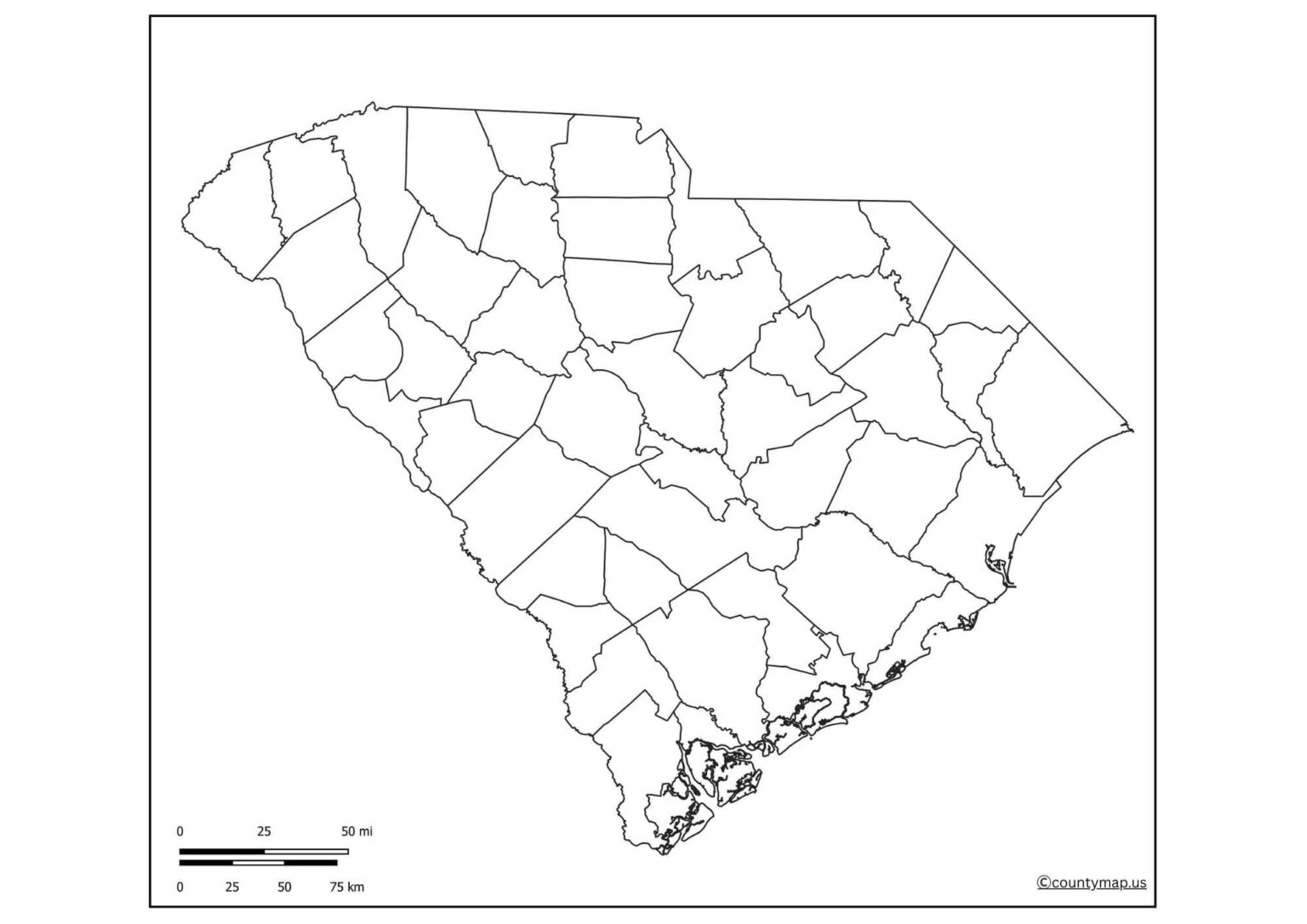
Blank maps also allow travellers to plan their trip, indicate the routes, attractions, and accommodations. Blank South Carolina maps are simple and can be used in a professional and personal way due to their simplicity and flexibility. They promote interactive learning, innovative projects and effective planning, which is why they are a very valuable geographic resource.
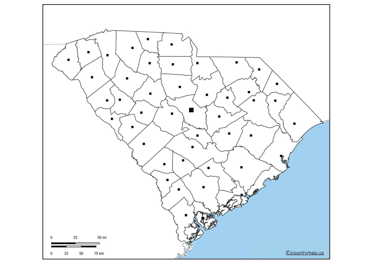
| City | County | Population (2024) | Area (sq mi) | Population Density (per sq mi) |
| Charleston | Charleston | 157,665 | 116 | 1,362 |
| Columbia | Richland | 144,788 | 137 | 1,055 |
| North Charleston | Charleston | 126,005 | 78 | 1,619 |
| Mount Pleasant | Charleston | 95,604 | 50 | 1,912 |
| Rock Hill | York | 75,798 | 44 | 1,722 |
| Greenville | Greenville | 74,371 | 29 | 2,573 |
| Summerville | Dorchester | 52,625 | 23 | 2,277 |
| Goose Creek | Berkeley | 50,352 | 42 | 1,199 |
| Greer | Greenville | 46,316 | 23 | 2,013 |
| Sumter | Sumter | 42,958 | 33 | 1,303 |
| Florence | Florence | 40,923 | 24 | 1,705 |
| Myrtle Beach | Horry | 40,535 | 23 | 1,764 |
| Spartanburg | Spartanburg | 39,606 | 20 | 1,980 |
| Hilton Head Island | Beaufort | 38,158 | 42 | 907 |
| Fort Mill | York | 36,244 | 20 | 1,812 |
Uses of Blank South Carolina SC Map Outline PDF
Educational Purposes
- Blank South Carolina maps have been popular in classrooms to teach geography, history and civics.
- Students will be able to name counties, large cities, rivers, and mountains, which will make them actively participate in the planning of the state.
- Blank maps can be used to create quizzes, assignments, and project-based learning, and they make the lesson more engaging and memorable to teachers.
Travel Planning
- Blank maps are beneficial to travellers when they are planning trips around South Carolina.
- In the historical area of Charleston up to Myrtle Beach and the beautiful Blue Ridge Mountains, users can use blank maps to highlight routes, mark attractions, and plan accommodations.
- Custom maps make navigation easier and travel better.
Research and Analysis
- Blank maps are used by researchers to depict visual data.
- Demographers, historians and political experts can be able to track population distribution, historical occurrences, vote counts or weather patterns.
- Blank maps are a versatile solution to visualising difficult information in a readable, visual format.
Business and Logistics
- Blank maps are used by businesses to map out distribution routes, delivery routes and service areas.
- Marking of warehouses, transportation hubs and sales territories can be done by logistics companies.
- Professional maps are used to enable organisations to visualise operations and efficiently make strategic decisions.
Community and Government Planning.
- Blank maps are used by local governments, NGOs, and community organisations in planning the population, emergency management and awareness campaigns.
- They can identify healthcare facilities, educational institutions, flood-affected regions, or infrastructure developments, so that their messages to the population are more efficient.
Imaginative and Individual Projects.
- Blank South Carolina maps are handy in artwork, colouring activities and other hobbies.
- Families can be shown in terms of migration or boundaries of history by genealogists and historians.
- They can also be employed in the production of decorative wall art or customised learning resources.
Tourism Promotion
- Blank maps are utilised by tourism boards and travel agencies to plan brochures, travel guides and marketing material designs.
- Marking tourist sites, trails, and places of interest on personalised maps is one way of making the state easily accessible and discoverable by tourists.
Conclusion
The Blank South Carolina Map is another versatile and handy resource that could be used by learners, educators, tourists, scholars, and practitioners. Its empty form can be easily customised and is suitable for learning, planning, artistic projects, as well as representing data. Having a print and online version, empty maps are an interactive and exciting method of studying the geography of the state, its history, and its sights. The Blank South Carolina Map can also be a valuable resource in any academic, travel planning, business strategy, and personal project and serves as a limitless resource of learning and exploration due to its simplicity, versatility, and practicality.


