Loading content...
Iowa County Map | IA Counties with Cities
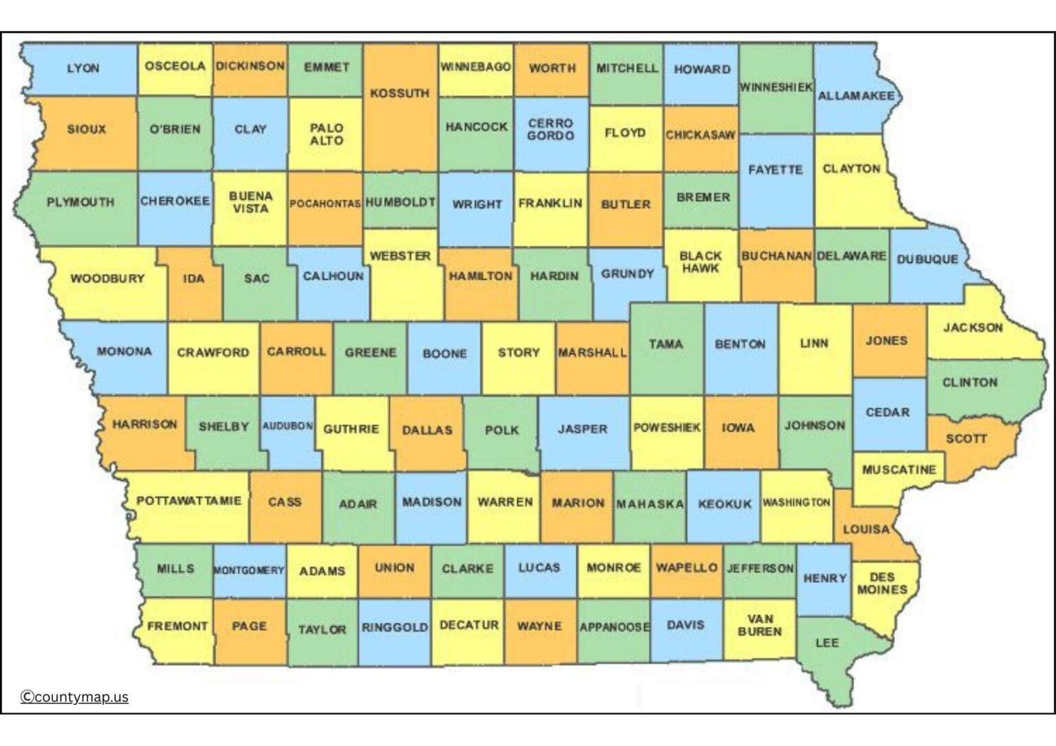
The Iowa County Map is a detailed and thorough illustration of all the counties in the Hawkeye State, including the identification of geographic borders, major cities, towns, and landmarks that assist residents, tourists, and researchers in navigating the state. The map serves as an indispensable resource for understanding population distribution, planning journeys, discovering historical sites, and researching cultural features within Iowa. Each county is colour-coded with accurate borders, differentiating county borders that work well for educational purposes, business planning, or personal reference.
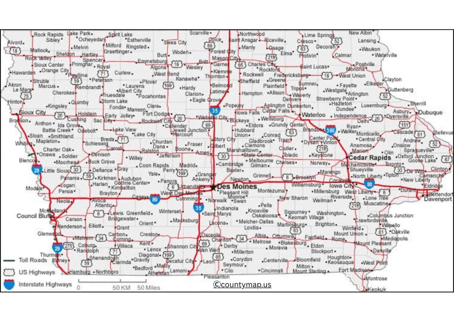
The Iowa County Map offers a complete visual map of the state, travelling over from the rolling central Iowa plains to the scenic rivers and small towns. The map is useful for logistics, real estate planning, governmental administration, or even outdoor recreation enthusiasts looking to explore Iowa's geography. The Iowa County Map is easy to read and provides accurate information for students, teachers, travellers, or anyone interested in learning about Iowa counties or geography.
Iowa County Map with Cities
An Iowa County Map with cities is an efficient instrument that shows all of the 99 counties in the state of Iowa and the major cities. Iowa is a state in the Midwestern United States, characterised by fertile farms, rivers, and urban centres that are on the rise. By pointing out cities in counties, it is easy to have a clear picture of how the population is distributed, economic activities, transport systems, and the development of the entire state regionally. An example of this is Polk County, which hosts the biggest city of Des Moines, which is a major area of finance, insurance, and publishing. Linn County boasts of an industrial and cultural city, Cedar Rapids, which produces, has technology and arts. Johnson County hosts Iowa City, the home of the University of Iowa, and one of the biggest educational, medical, and research facilities.
The county map of cities comes in handy in various ways. It is used by students and researchers to investigate the geography of Iowa, the patterns of urbanisation and the changes in the demographics. It is the source of navigation among the travellers, as it helps them to comprehend the regional relationships and discover major destinations. The map is useful in the planning of infrastructure, economic development, and emergency management by policymakers and planners. The visualisation of the counties with their cities aids in the analysis of the relationship between the regions, transportation routes, and cultural centres, which gives a comprehensive idea of how the counties of Iowa operate on both individual and general levels.
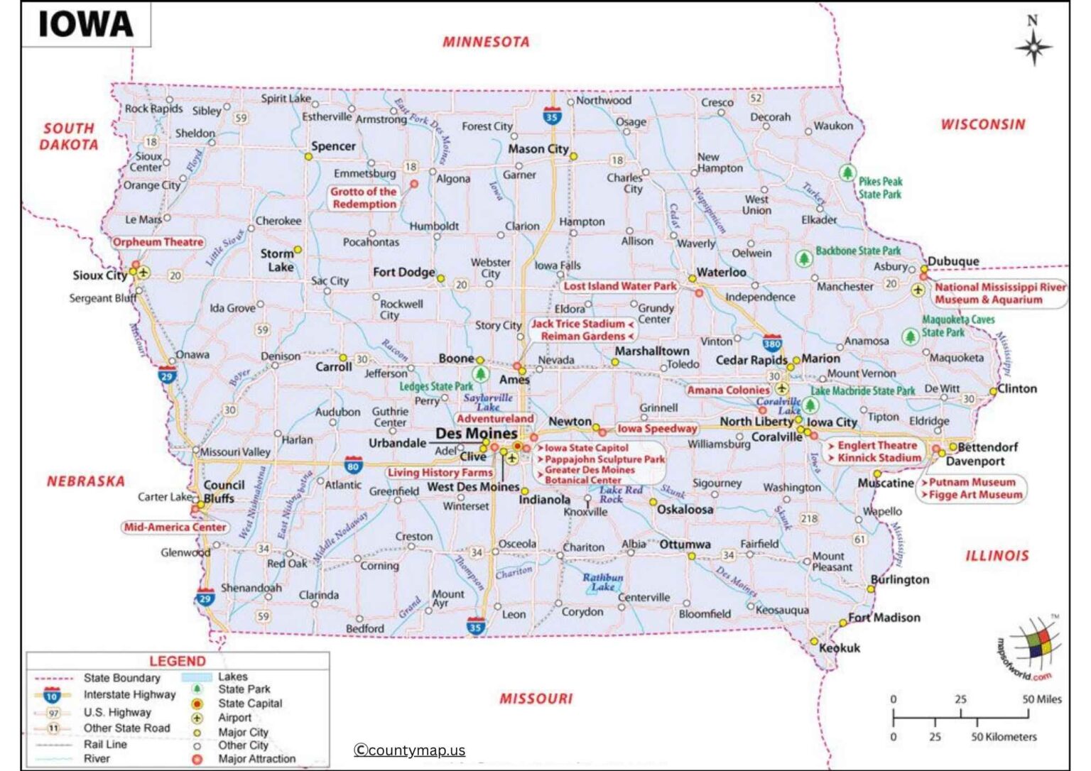
Iowa County Map with Capital
An Iowa County Map, which points out the state capital, points out the city of Des Moines, Polk County. Des Moines is the political, economic, and cultural centre of the state of Iowa, where the office of the Governor is located, the state legislature, and many other administrative departments. The map depicts all 99 counties with the central position of the capital highlighted and how it is connected to the rest of the state. Des Moines is vital in the administration, other than in the governance. Being a financial centre of finance, insurance, publishing, and technology, it has an economic impact on the economic activities of the other surrounding counties.
The capital-oriented map is found to be very useful in the case of students, travellers, government officials, as well as business planners. It provides information about political geography, administrative breakdowns at the county level, and connectivity of the region. It allows planners and policymakers to plan the development of urban areas, control the activities of the state services, and organise emergency interventions. Also, the map will be an important educational resource, as it will contribute to the visual representation of the interaction of the state capital and counties and cities in business, governance, and cultural life.
Conclusion
The Iowa Maps containing cities and the capital are very critical to comprehend the geographic, economic, and governance of the state. On maps with cities, the urban centres and areas of regional interest are emphasised, whereas the maps with Des Moines are oriented on the administrative, economic, and logistical role of the capital. Collectively, these maps can be used by students, travellers, researchers, and policymakers as a comprehensive visual depiction of the counties, cities, and transportation in Iowa, to help in the process of education, planning, and exploration.