Loading content...
Tennessee County Map | TN Counties with Cities
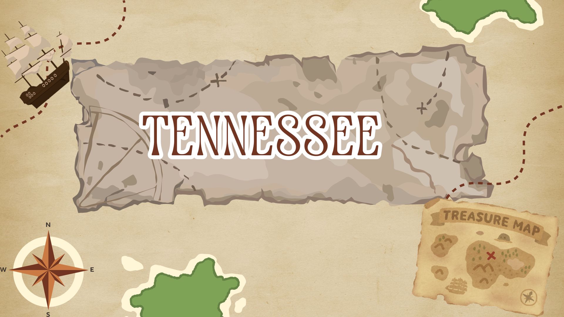
The Tennessee County Map presents a collective view of all counties in the State of Tennessee, their locations and cities, highways, rivers and waterways, and other geographical characteristics. Tennessee has 95 counties, each with its own culture, history, and economy. The map visually indicates where each of the county boundaries lies, which can be beneficial, especially for school students, researchers, travellers, and planners.
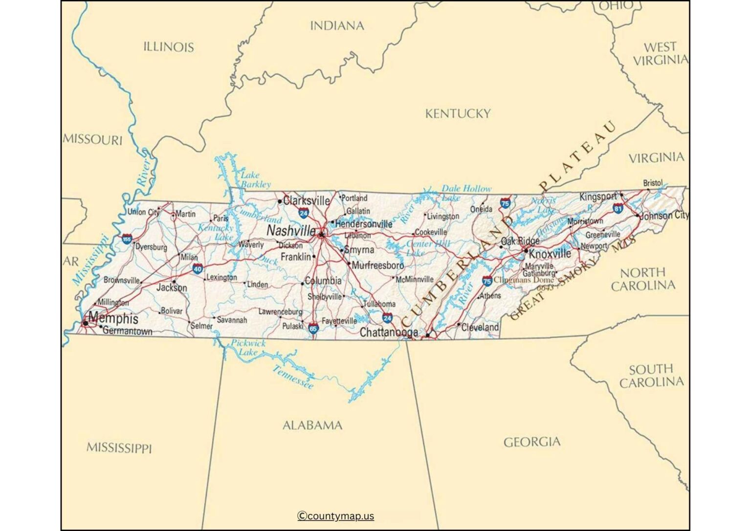
The map indicates the important urbanised areas, like Nashville, Memphis, and Knoxville, and also gives the character of rural areas and towns from which to derive population density and parts of the state. Tennessee contains elevation changes with mountains, plateaus, rivers, and fertile plains, and the county map assists in indicating how these geographic features reflect human population settlement and transportation systems.
This map is a helpful way to navigate through TN beyond educational needs, but as a tourist resource and planning guide to assist in gaining a clear view of the distinct administrative and natural divides that are present in Tennessee counties.
Tennessee County Map with Cities
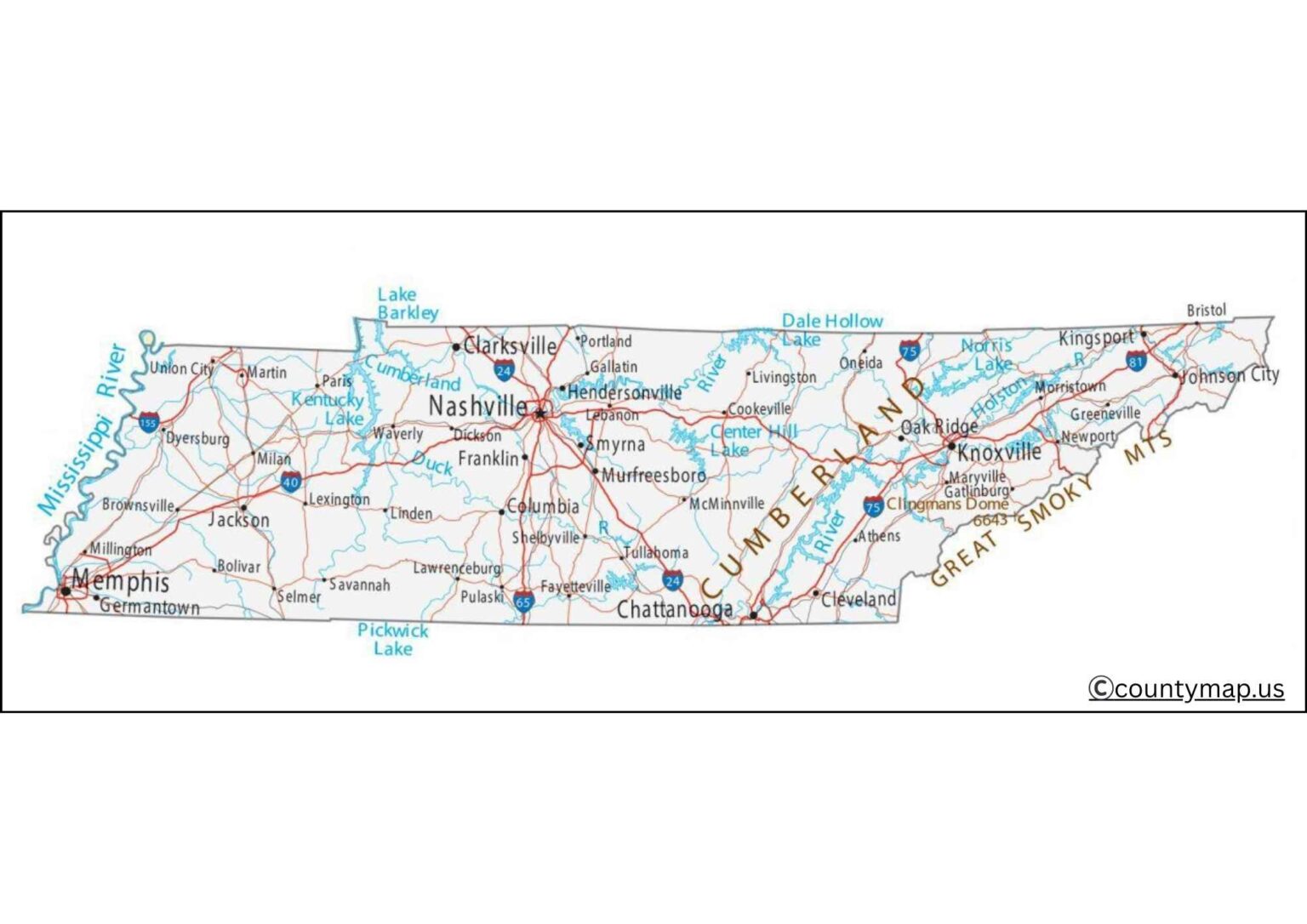
The map of Tennessee counties that has cities gives a good idea of the administrative units as well as cities in the state. The state of Tennessee consists of 95 counties with urban centres, towns, and rural areas. These maps play a critical role in comprehending the distribution of populations, the economic activity, and the local geography of the entire state.
Tennessee county maps show such large cities as Nashville (Davidson County), Memphis (Shelby County), Knoxville (Knox County), Chattanooga (Hamilton County), and Clarksville (Montgomery County). The state capital, Nashville, le boasts the music industry, cultural landmarks, and educational institutions. Memphis is well known in terms of historical value, river trade, and blues culture, whereas Knoxville and Chattanooga are the big industry, learning, and sightseeing centres.
Smaller yet significant cities, like Murfreesboro (Rutherford County), Jackson (Madison County), and Johnson City (Washington County), are contributing to the economy of the state and offer services to the region. The cities of Eastern Tennessee are embedded in the Appalachian mountains, whereas the cities of Western Tennessee are affected by the Mississippi River and fertile plains.
A county map and cities assist the users in comprehending the connection between population centres and the boundaries of counties. It is an effective aid to students, researchers, travellers, and planners, providing information about the transport networks, settlement patterns, and economic centres. These maps give the full picture of the demographics, culture, and economic picture in Tennessee by combining the counties and cities.
Tennessee County Map with Capital
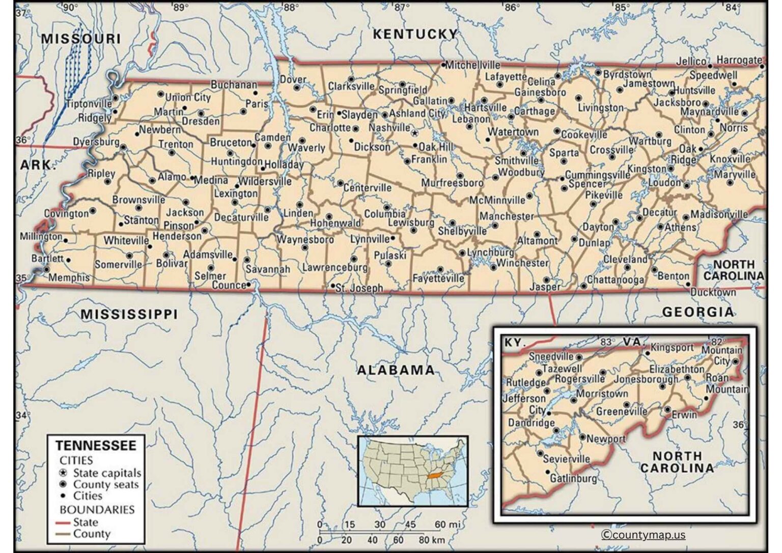
A map of Tennessee counties highlighted by the capital is used to highlight the county seats, which are the administrative centres of each county. The 95 counties in Tennessee have their counties each with a counting seat, where government offices, cocourthousesand public services are based.
The administrative centre is the conspicuous University of Nashville (Davidson County), the capital of the state. In Nashville, there is the office of the governor, the state legislature, and other important government agencies. It is a cultural and economic hub as well as a centre of ruling, in addition to music tourism and education.
Other major county seats are Memphis (Shelby) and Knoxville (Knox), Chattanooga (Hamilton), Clarksville (Montgomery), and Murfreesboro (Rutherford). These county towns are centres of government, commerce, and civic amenities to the adjacent towns and country districts. Smaller county cities, including Greeneville (Greene County), Columbia (Maury County), nd Dyersburg (Dyer County), retain local administrative services and services to the community.
The map of Tennessee counties that includes capitals is a good indication of the administrative system and the organisation of the state. It brings out the role of the county seats that unite the rural and urban community, making governance, the administration of law, and the delivery of services possible all over the state. These maps are priceless to researchers, travelers, students and policymakers who want to follow each county structure of Tennessee which is so complex.
Conclusion
County maps of Tennessee with cities and capitals give the whole picture of the geography and the government of this state. The maps that show cities and their centres are economical, cultural, and even people, such as Nashville, Memphis, and Knoxville, whereas the maps with capitals focus on the governance and on the counties. Collectively, they disclose the balance between the cities and the countryside, the services in the region, and the town arrangements. The maps serve various purposes such as education, travelling, research, and planning, giving one a clear insight into the social, economic, and political landscape of Tennessee. The combination of the two views gives one a global picture of the state organisation and local diversity.