Loading content...
Pennsylvania County Map | PA Counties with Cities
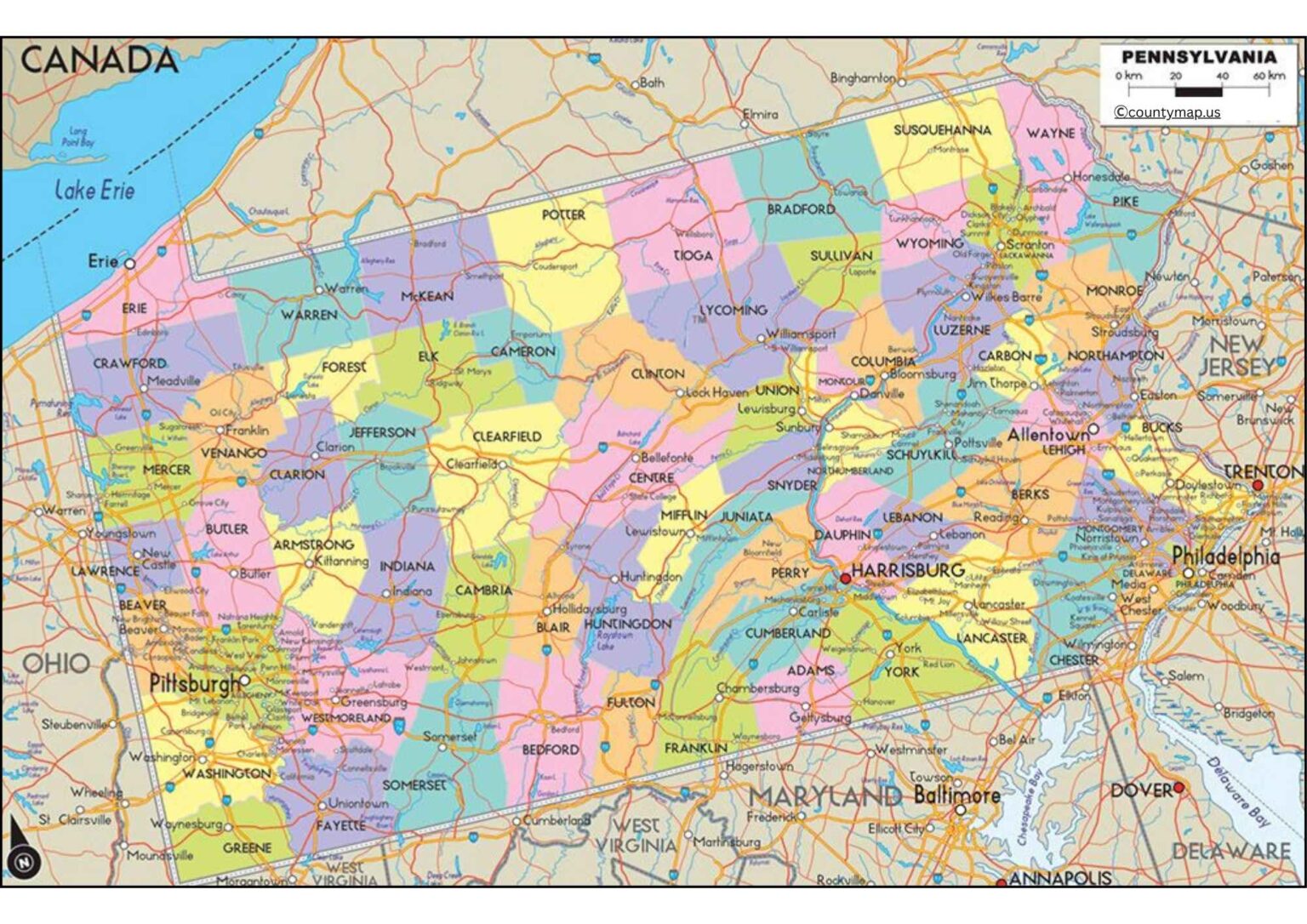
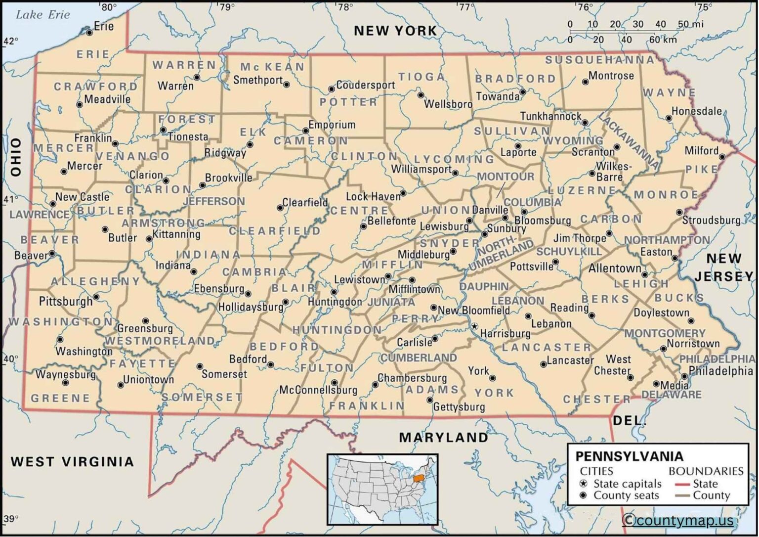
Pennsylvania County Map: There are 67 counties boasting their own cultural and economic history, and the county map allows us to explore urban metropolises like Philadelphia, Pittsburgh, and Harrisburg, along with smaller towns and the land of trees and farms, and to see how all of these things impact settlement patterns and economic activity in the state.
Pennsylvania County Map with Cities
The Pennsylvania County Map also shows off the beauty of the different terrains that Pennsylvania is made of: the mountains, the forests, the rivers, and the fertile plains, while allowing a clear understanding of how all of these things influence settlement patterns and economic activity in the state.
An overview of the Pennsylvania county map and cities is an informative map that shows the administrative and urban setup of the state. The state of Pennsylvania is broken down into 67 counties, in which there are diverse cities, towns, and boroughs. These maps are critical in comprehending the population, economic centers, and transport roads across the state.
The economic, cultural, and historical center of the state is the largest city, Philadelphia (Philadelphia County). Philadelphia, a major metropolitan center, is known for its rich history, universities, and exciting arts scene. Another large city is Pittsburgh (Allegheny County) in western Pennsylvania, which is a city with a history of industry, technology, and cultural organizations. Other important cities that form a part of commerce, education, and regional development are Allentown (Lehigh County), Erie (Erie County), and Reading (Berks County).
Pivotal urban areas include parts of central and northern Pennsylvania, such as Harrisburg (Dauphin County), Scranton (Lackawanna County), and State College (Centre County), which serve educational, governmental, and commercial purposes. The area has also been a political and administrative hub; its seat is also in Harrisburg, the state capital.
A county map with cities is used to show the connection between counties and urban areas, population density, and influence. The Philadelphia metropolitan area dominates Eastern Pennsylvania, and the city of Pittsburgh dominates Western Pennsylvania. Smaller yet economically significant cities are also disclosed on the map, which are scattered all over the central and northern regions, assisting in planning travels, economic analysis, and education. The map provides a clear picture of the demographic, cultural, and economic situation in Pennsylvania by merging the counties with the places of cities.
Pennsylvania County Map with Capital
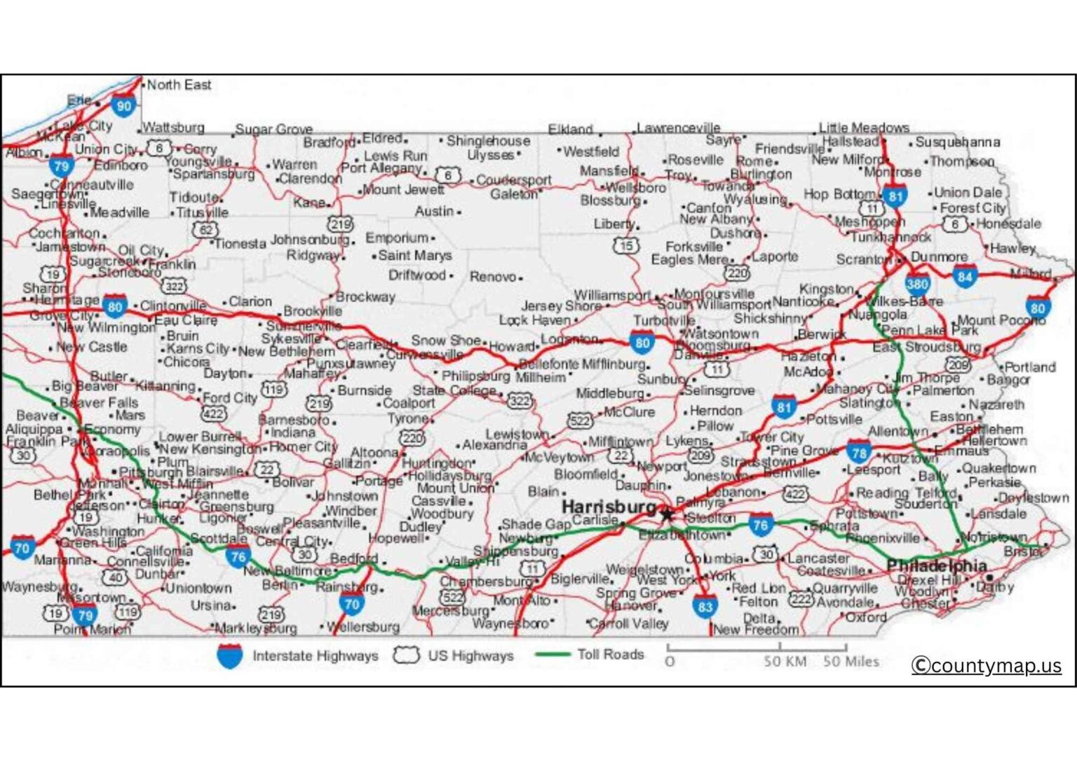
The Pennsylvania county map with capitals dwells on the capitals, which are administrative centers of governance and local services in a county. The 67 counties have their respective county seats, which are most often characterized by the presence of the courthouses, the government buildings, and the people's services.
Harrisburg (Dauphin County) is a large administrative center in the state capital. It houses the office of the governor, the state legislature, and many departments of the government. Harrisburg is also prominent in terms of commerce, transportation, and historical tourism, which makes it the focal point of the governance and economy of Pennsylvania.
Other prominent county seats are Philadelphia (Philadelphia County), Pittsburgh (Allegheny County), Allentown (Lehigh County), Erie (Erie County), and Reading (Berks County). These county centers serve as centers of administration, business, and services provided to the local communities. Smaller county seats, including those of Carlisle (Cumberland County), York (York County), and Williamsport (Lycoming County), have local administrative needs and supply local service.
The political and administrative geography of Pennsylvania is impossible without having a county map with the capitals. It depicts how governance is organized both in the urban and the rural regions, how the county seats unite the communities, and how they can be used to deliver public services. These maps are useful to policymakers, students, travelers, and scholars.
Conclusion
The county maps of Pennsylvania with towns and capitals provide complementary information about the state. City maps concentrate on economic, educational, and cultural capitals (such as Philadelphia, Pittsburgh, and Allentown), whereas maps with capitals concentrate on government and administration capitals (such as Harrisburg). All of them indicate the urban-rural distribution of the state, the services offered by the state, and its demographic trends. These maps are crucial educational and travelling materials as well as planning and research tools, with which one could have a complete picture in terms of the geography and the administrative system of Pennsylvania. It is possible to see the social, economic, and political situation in the state by combining both visions.