Loading content...
Ohio County Map | OH Counties with Cities
The Ohio County Map is a well-elaborated resource that highlights the 88 counties of the state and their geographical arrangement, as well as the main places of interest. The state of Ohio has diverse landscapes, such as cities, farmlands, rivers, and lakes, and a county map is thorough and user-friendly to navigate through these areas. The map identifies major cities, towns, highways, rivers, and landmarks, and therefore it will be helpful to students, travelers, researchers, and residents.
Printable Ohio County Map with Cities
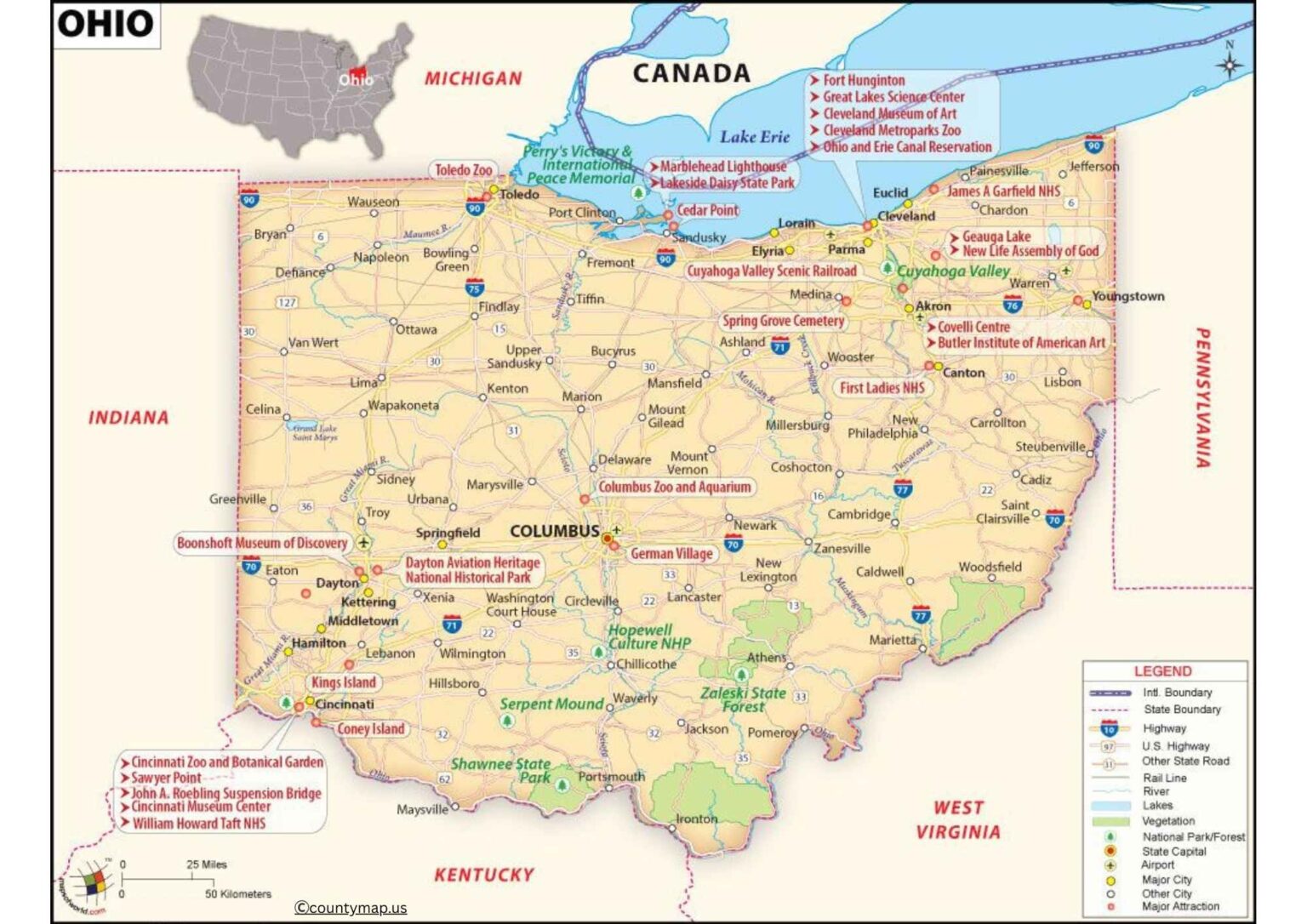
It is very useful in the planning of road trips, when one wants to learn the local history, the population distribution, and the economic as well as cultural differences among the counties. The map can be vital in the fields of education, government planning, and tourism by showing county boundaries and county seats as well as transportation networks. The Ohio County Map is readable and clear, and it provides an entire overview of how the state is organized and allows users to investigate its communities and natural features with precision and ease.
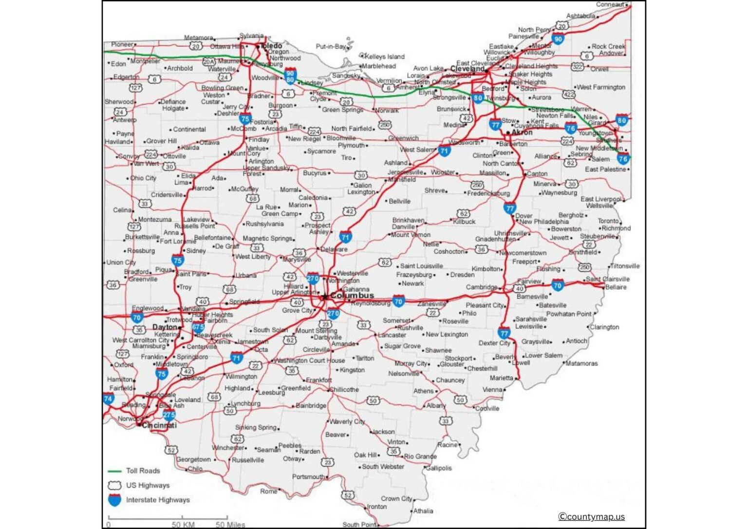
Ohio County Map with Roads
The state of Ohio is in the Midwest of the United States, and it comprises 88 counties, each having its unique peculiarities, economy, and cultural values. Key counties are Cuyahoga County, which hosts Cleveland, one of the largest cities in the state; Franklin County, which hosts Columbus, the largest city in the state and capital city of the state; and Hamilton County, which hosts Cincinnati, a major economic and cultural center. Other significant counties are Summit County (Akron), Montgomery County (Dayton), and Lucas County (Toledo).
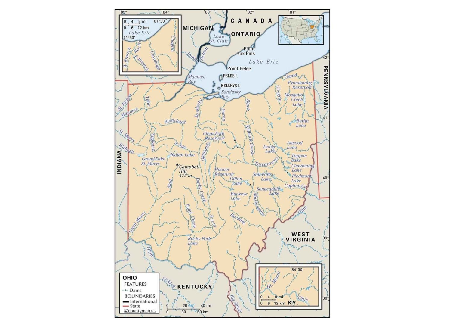
All the counties are mixed with urban, suburban, and rural spheres. Cities such as Cuyahoga and Franklin counties are densely populated with good infrastructure and flourishing industries that are in finance, healthcare, and education. By comparison, other counties like Adams, Gallia, and Noble are more rural, and agriculture and small towns are the main economic activities. In Ohio, another important natural feature, as shown by its county map, is Lake Erie to the north, the Ohio River on the southern border, and a number of state parks and forests.
County-based cities are economic, cultural, and transportation hubs. As examples, Cleveland (Cuyahoga County) has a reputation for medical institutions and arts, Columbus (Franklin County) has a reputation for government and educational institutions, and Cincinnati (Hamilton County) has a reputation for commerce and historical architecture. County boundaries are also usually based on historical settlement areas, rivers, and geographical features. The county map of Ohio is a useful instrument to understand the distribution of populations across the state, the accessibility of the area, and the economic activity of the state as a whole, exhibiting that urban centers and rural areas characterize the identity of the state.
Columbus, the capital of the state, is marked in the Ohio county map in Franklin County in central Ohio. Its location is at the center of Columbus and can be easily reached by a majority of the regions within the state, making it the political, economic, and cultural center. The city contains the State Capitol building, significant governmental offices, and various historical sites. It is also located in Franklin County and can be used as a major transportation nexus, where the most important highways, such as I-70, I-71, and I-270, pass, linking Columbus with other counties and the main cities of Cleveland, Cincinnati, and Dayton.
Franklin County covers Columbus and its core, with Columbus and the population and commerce it encloses comprised of Delaware, Licking, Fairfield, Madison, Pickaway, and Union counties forming a regional population and commerce hub. The county map reveals the impact of the county of Columbus on the other counties in terms of economic opportunities, educational institutions, and health services. Moreover, Columbus has been a cultural hub with great sporting and university teams, theaters, and festivals, which bring people from the surrounding counties.
Ohio County Map with Capital
The map of the Ohio county with the capital marked gives a clear view of the governance and connectivity. When other cities, such as Cleveland and Cincinnati, are taking a lead in terms of population and business, Columbus provides centralized management and coordination of the whole state. The map also depicts the natural features, rivers, and the borders of the county, highlighting the strategic position of the city in the connection of the northern, southern, and eastern parts. The key to regional planning, infrastructure development, and the overall understanding of the ways the capital is incorporated into the larger Ohio terrain is understanding this map.
Conclusion
The county maps of Ohio, including the cities and the capital state, demonstrate the demographic, economic, and cultural diversity in the state. Counties are not only urban areas, such as Cuyahoga, Franklin, and Hamilton, but also rural areas, such as Adams and Noble. Economic, cultural, and transportation systems are based on major cities like Cleveland, Columbus, Cincinnati, Toledo, and Dayton; Columbus, which is right at the center of Franklin County, is the administrative and political center. These maps can give useful information about the population, the connectivity of the regions, the infrastructure, and the natural features. Combined, they depict the interaction between the counties and the cities in Ohio to determine the state's identity, development, and political leadership.