Loading content...
Oklahoma County Map | OK Counties with Cities
The Oklahoma County Map is a valuable guide to the counties of Oklahoma and the boundaries of each county, as well as the major cities, highways, and other landmarks within each county, whether travelling there or merely seeking knowledge of the geographic and administrative boundaries of the state.
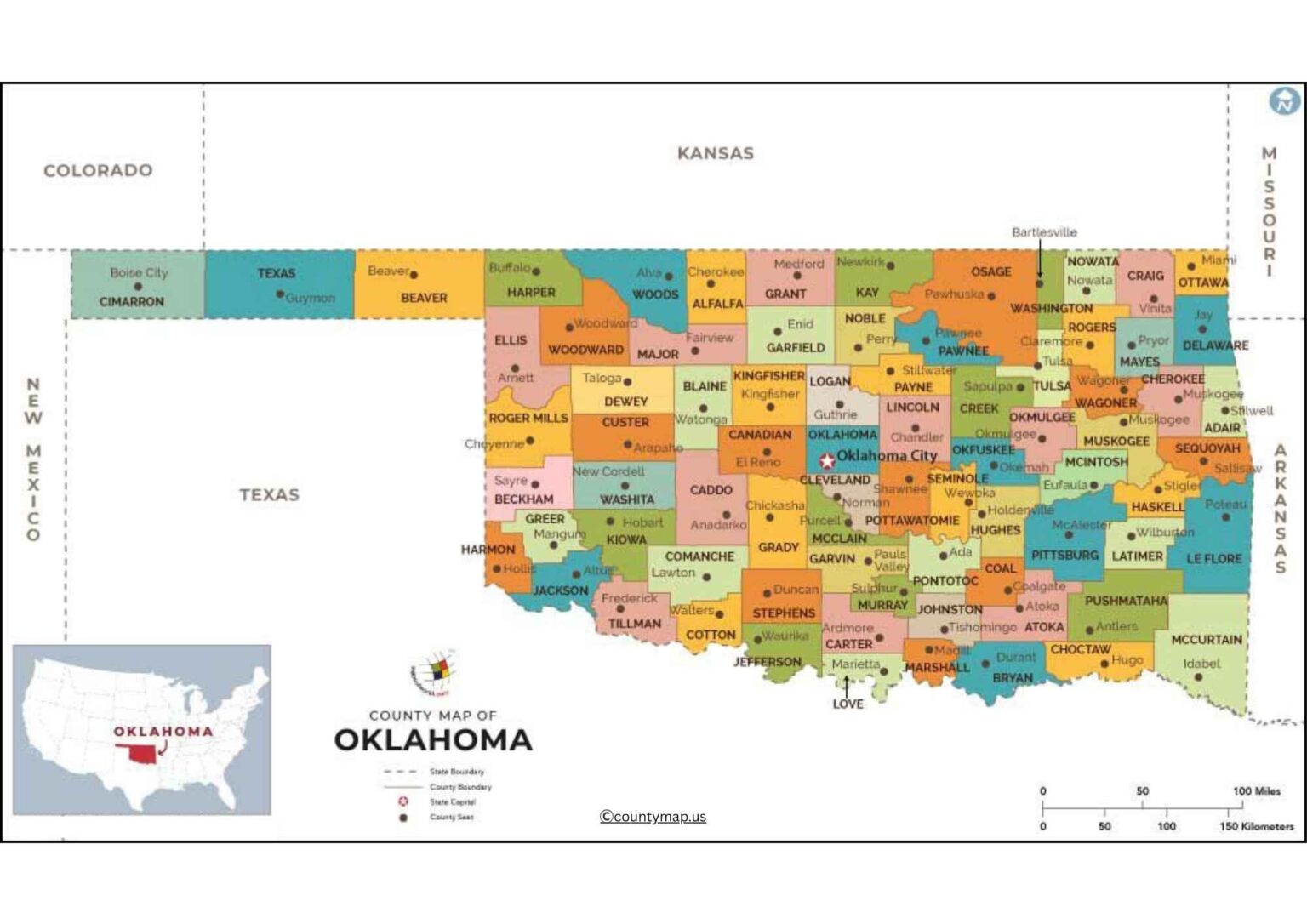
The Oklahoma County Map can easily identify the location of each county in the state, including such counties as Oklahoma County and Tulsa County, but also some of the more rural areas of the state, such as Cimarron and Harper, providing a clear and understandable overview of the boundary of each county and its location in the State.
Oklahoma County Map with Cities
Oklahoma is a state in the south-central part of the United States, which is made up of 77 counties comprising a diverse number of cities and towns based on the diverse cultural, economic, and geographical land of the state. A county map featuring cities identifies the way in which the population and commerce are spread out in urban, suburban, and rural regions. The largest city in the state and a business, government, and cultural centre is Oklahoma City, which is situated in Oklahoma County.
Other major cities are Tulsa (Tulsa County), which boasts of the energy industry and a thriving arts community, Norman (Cleveland County), where the University of Oklahoma is located, and Edmond (also in Oklahoma County), which is an emerging suburban hub. Lawton (Comanche County) is a regional military and industrial centre, and Broken Arrow (Tulsa County) and Moore (Cleveland County) are major suburban cities that serve the local economies.
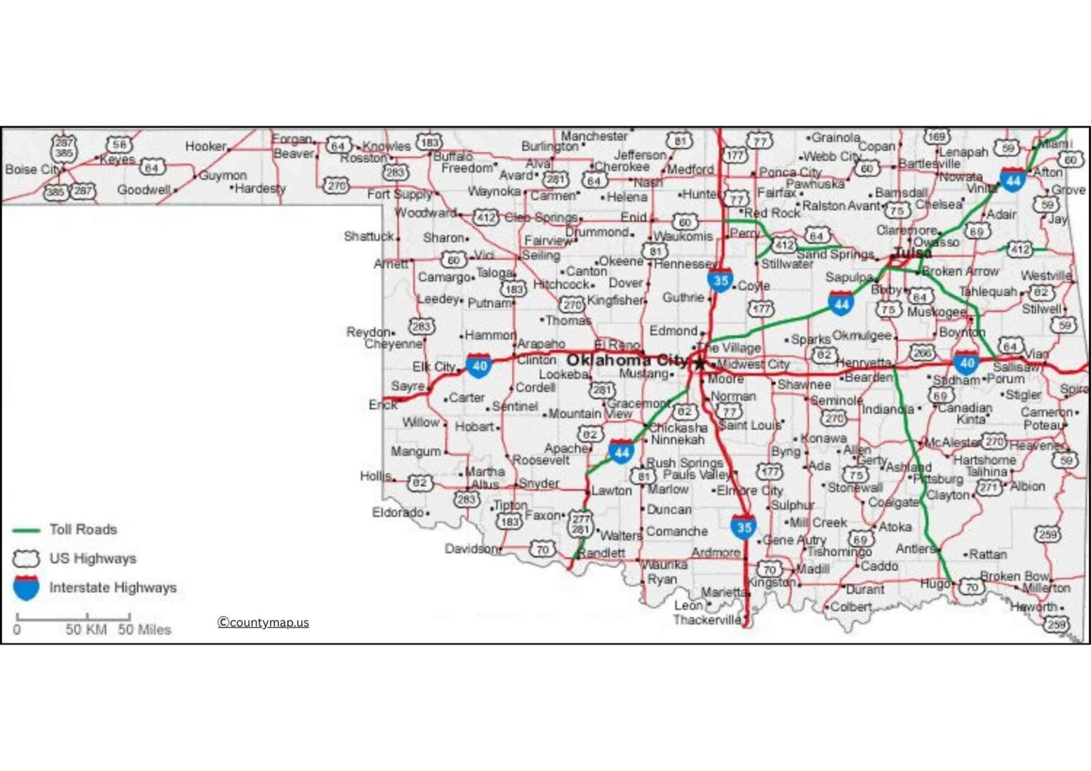
Smaller towns such as Enid (Garfield County), Muskogee (Muskogee County), and Stillwater (Payne County) are sources of education, agriculture, and commerce. Eastern counties such as Muskogee, McAlester, and Idabel have smaller urban centres that are needed to provide local services and area trade. Western counties, including Woodward and Elk City, are those that encourage energy production, farming, and ranching.
A county map of Oklahoma with Cities gives a clue on the population centres, zones of the economy and transport systems, and how the urban, suburban, and rural communities interact to create a dynamic and balanced state.
Oklahoma County Map with Capital
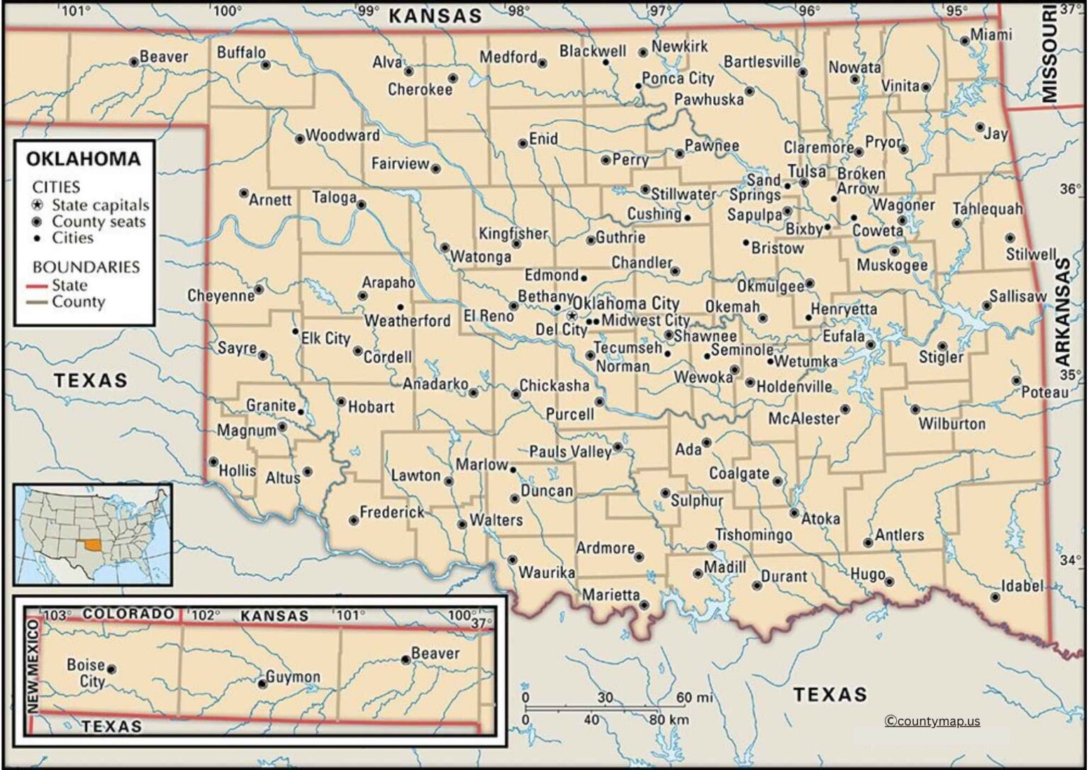
An Oklahoma county map that highlights capitals is concerned with the county seat, the administrative, judicial, and government centre. The seat of Oklahoma County is Oklahoma City, which happens to be the state capital and thus the centre of state government and policy. The other counties, e.g,. Tulsa (Tulsa County) or Norman (Cleveland County) are the regional administrative and economic centres. The county has a seat of Lawton, which deals with governance and assists military missions in Fort Sill.
County seat governments in the Eastern part of Oklahoma, such as Muskogee (Muskogee County) and McAlester (Pittsburg County), serve in combination roles as local government, historical, and economic. Such seats of central Oklahoma as Stillwater (Payne County) and Guthrie (Logan County) are present in terms of educational and historical interests, whereas western county seats like Woodward and Elk City deal with rural administration, vitality, and farmland. Less populated areas have smaller towns, such as Ada (Pontotoc County) and Idabel (McCurtain County), that continue to have necessary administrative and judicial services.
An elaborate county map with capitals assists residents, researchers, and policymakers in locating the centre of governance, judicial activities, and services of a region, giving a grand picture of the political and administrative structure of Oklahoma. This map makes the government services accessible to the densely populated and rural regions, which is a mixture of the city and countryside governance of the state.
Conclusion
The county maps of Oklahoma, which point to cities or capitals, give an impressive view of the geographic, economic, and administrative landscape of the state. The city maps feature the city centres such as Oklahoma City, Tulsa, and Norman, as well as the smaller towns that are needed to support commerce and education within the region. The maps of the counties are focused on governing and the services provided by them, and Oklahoma City, Tulsa, and Lawton are the most important administrative centres. Combined, these maps will show how Oklahoma strikes a balance between the urban development and rural control, providing insights into the population density, economic, as well as governmental division, and organisation, and being invaluable resources to both the residents and students, as well as planners.
Latest Maps
View All →