Loading content...
South Dakota County Map | SD Counties with Cities
The South Dakota County Map provides a concise and clear representation of the state's 66 counties, including their boundaries, major cities, highways, and other landmarks. This map can be used as an efficient tool for planning a road trip, as it offers information on population distribution, geographical areas, and the surrounding landscape. Providing valuable information about the counties of the state and their local features, small city centers, large highways, and other geographical landmarks.
South Dakota County Map
The map can be used by students, travelers, researchers, and others to plan a road trip to the state and observe its distinct features and manifestations.
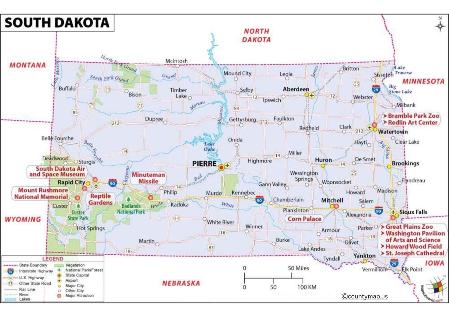
South Dakota is in the northern Great Plains of the United States and is subdivided into 66 counties, which possess distinctive geographic, economic, and social characteristics. Meade County is the biggest in terms of area, and Minnehaha County is the biggest in terms of population. The largest city in the state and a significant economic center is Sioux Falls, which is located in Minnehaha County. The other major cities are Rapid City, the Pennington County gateway to the Black Hills; Pierre, the state capital; Aberdeen, Brown County; and Brookings, Brookings County.
Every county is a combination of urbanized areas, towns, and countryside. An example is Lincoln County, which is a fast-growing suburban area of Sioux Falls, whereas counties such as Harding and Jones are sparsely populated with vast prairie land. The map of the county of South Dakota also shows a number of Native American reservations, such as the Pine Ridge in the Oglala Lakota County and the Rosebud in the Todd County, which adds cultural diversity to the state.
South Dakota County Map with Cities
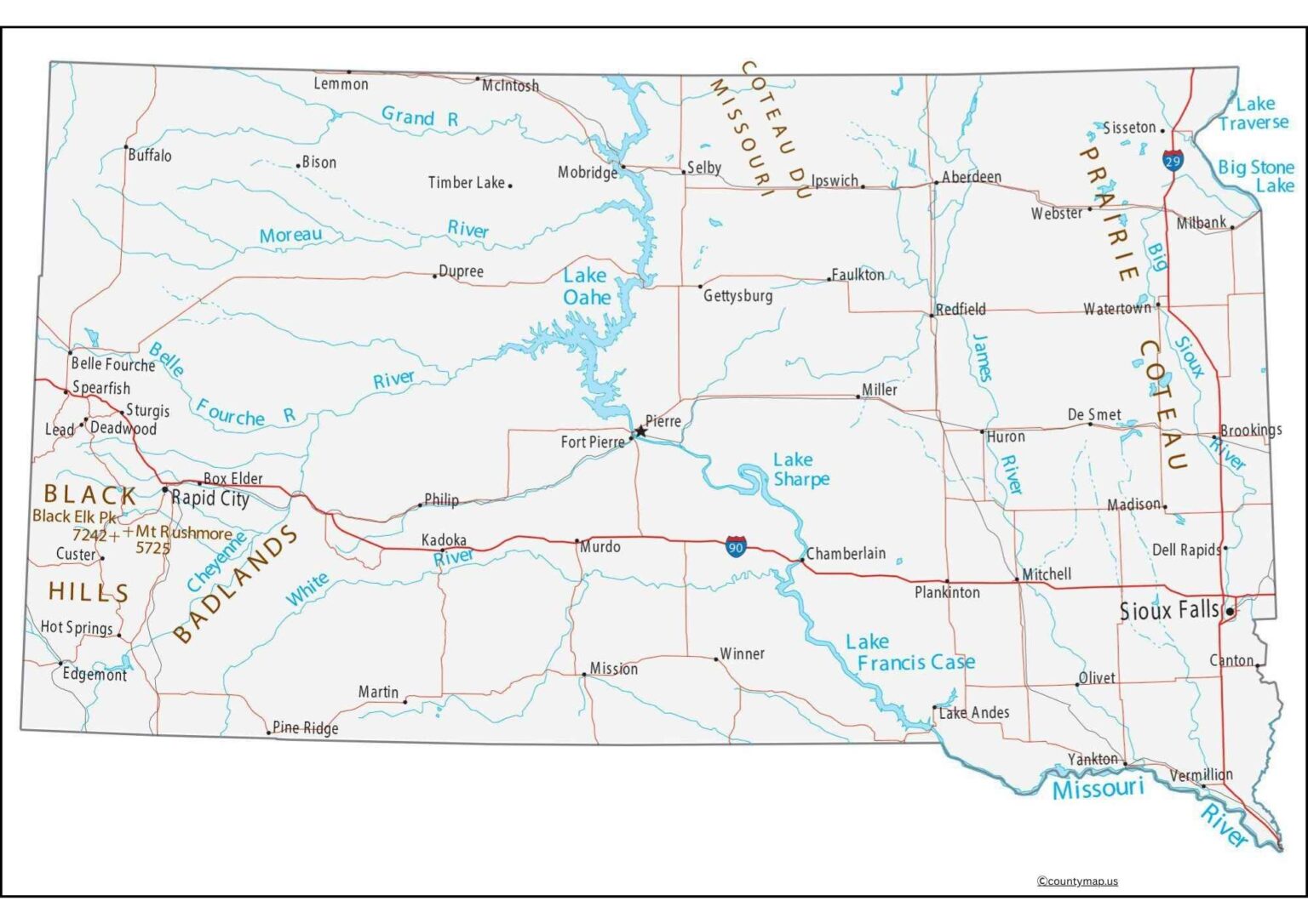
The counties of Pennington, Lawrence, and Meade offer tourist attractions such as Mount Rushmore, the Badlands, and the Black Hills National Forest. Counties such as Brown, Bon Homme, and Brookings are largely agricultural land where the crops of corn and soybeans and cattle farming dominate. The boundaries of the counties tend to follow natural landforms such as rivers and ridges, and highways, railroads, and large water bodies that link the urban and rural areas are depicted on the map. The county map of South Dakota is a crucial tool for discussing demographic trends, economic hubs, and cultural landscapes in the state, as it provides insight into the diverse regions of South Dakota.
The map of the South Dakota county focuses on Pierre, the state capital, which is situated in Hughes County and is the geographical center of the state along the Missouri River. The location of Pierre is central, and hence it is accessible from most areas; however, it is very small in comparison to large cities such as Sioux Falls or Rapid City. It is the political and administrative center, with the State Capitol building, the government offices, and other historical landmarks being located there.
Free South Dakota County Map with Capital
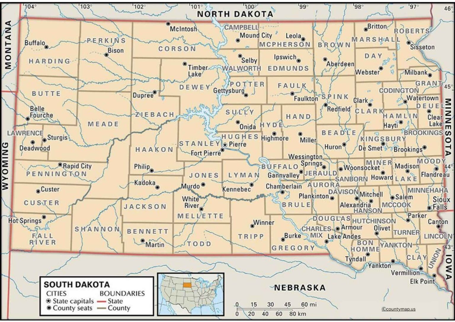
The county of Hughes, in which Pierre is living, has other counties like Stanley, Hyde, Sully, and Potter that create the central corridor of governance and regional services. The population of the county is small, yet it is a strategically located area because of its closeness to the Missouri River and other major roads such as U.S. Highway 83 that links the northern and southern sides of the state. The map shows that Pierre is connected to the neighboring counties, which implies that it serves as an education, trade, and cultural hub.
The county map of South Dakota, with the capital outlined, gives a breakdown of the way Pierre is incorporated in the other counties. It is needed to comprehend transportation routes and administrative jurisdictions, and regional planning. As other cities such as Rapid City and Sioux Falls overpower with their size and economic life, the presence of Pierre guarantees centralized governance of the whole state. The map also indicates the distribution of the counties along the east-west axis, rivers, and the states adjacent to it, like North Dakota, Minnesota, Iowa, Nebraska, Wyoming, and Montana, which places the capital in a greater regional context.
Conclusion
The county maps in South Dakota with cities and the capital outline the geographical and cultural diversity of this state. Counties are varied, with some being densely populated urban centers, such as Minnehaha; others being spacious rural communities, like Harding; and others being economic, political, and cultural hubs, such as Sioux Falls, Rapid City, and Pierre. Pierre, which is in the center of Hughes County, plays the role of the administrative center, and the state is connected by this. These county maps are important in the understanding of the South Dakota demographics and infrastructure, governance, and natural landmarks. They give a good image of the interaction of communities, transportation, and government in the state, showing the special mixture of urban and rural landscapes and the history of South Dakota.


