Loading content...
Wisconsin County Map | WI Counties with Cities
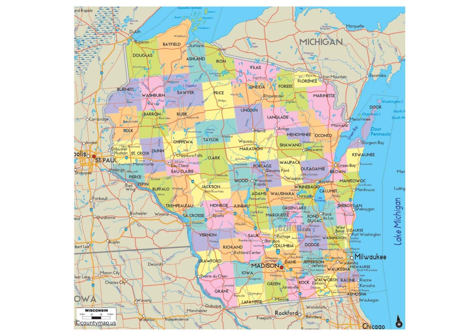
The Wisconsin County Map would be a crucial source of information regarding the geographical, boundary, and administrative aspects of the state. Wisconsin, with 72 counties, boasts of variety in its landscapes with the Great Lakes shoreline, rolling agricultural areas, thick forests, and bustling urban areas. It is a great resource to students, researchers, travellers, and residents alike since it is a detailed county map that shows the major cities, towns, highways, rivers, and other natural features.
Wisconsin County Map with Cities
You may be planning a road trip or studying the history of the region or examining economic and cultural variations among counties; the map offers a good idea of how Wisconsin is organized. It is also useful in the search for county seats, the search for transport routes, as well as the search for recreational places such as parks and lakes. The Wisconsin County Map is significant in decision-making and analysis among businesses, educators, and government planners. And being easy to read and accessible, it provides a full picture of the layout of the state and would be ideal in both education and application.
The map of the Wisconsin counties with cities gives an in-depth look at the 72 counties of the state and main cities in them to comprehend the distribution of population, economic centers, and local culture. The state has the largest cities in major counties like Milwaukee, Dane, Waukesha, and Brown. The county of Milwaukee houses the largest city of Wisconsin, Milwaukee, which has its own industry, cultural institutions, and port on Lake Michigan.
The county of Dane contains the state capital of Madison, a key educational and political center that has the University of Wisconsin. Green Bay is an area in Brown County with manufacturing companies, commerce, and an NFL team. Racine (Racine), Kenosha (Kenosha), and Outagamie (Appleton) are other important counties that contribute to the local economy, trade, and tourism. Smaller towns, natural scenery, and leisure activities can be viewed in the northern counties of Vilas and Oneida, whereas riverside cities and cultural centers can be seen in such western counties as La Crosse and Eau Claire.
Wisconsin County Map with Roads
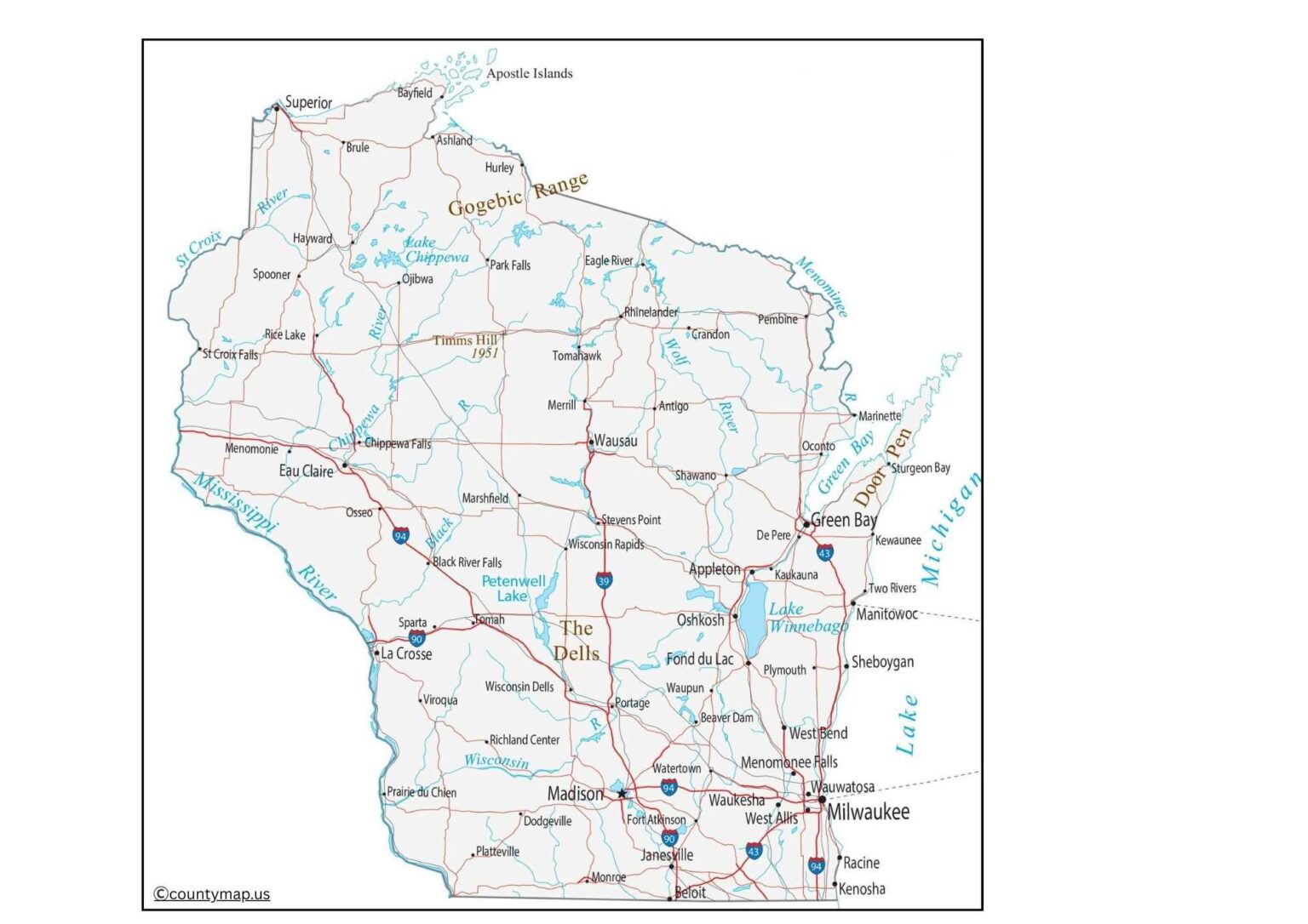
A county map containing cities assists in visualizing the distribution of urban and rural areas, showing how cities are connected through highways, rivers, and other structures. These maps are also helpful to travelers, researchers, teachers, and companies that intend to operate throughout Wisconsin. They also emphasize the geographic variety of the state, including industrial and educational cities as well as agricultural and tourism-oriented settlements, in which there is a complete insight into the urban geography and regional development of Wisconsin.
A county-wise map of Wisconsin highlights the capital areas, which are administrative and political centers of the 72 counties in the state. Government offices, courts of law, and civic institutions are located in each county seat, making it a central point of government and government services. As an example, Madison is the seat of the county of Dane as well as the state capital, so it is a center of political, administrative, and educational activities.
Milwaukee is both the largest city and the county seat of Milwaukee County. The seat of Brown County is Green Bay, and the seat of Eau Claire County is Eau Claire. Other significant county seats are La Crosse in La Crosse County, Wausau in Marathon County, and Oshkosh in Winnebago County. County seats are also small towns in comparison with the largest city in their counties but are historic and important to the county, with civil events every year and local heritage.
Wisconsin County Map with Capital
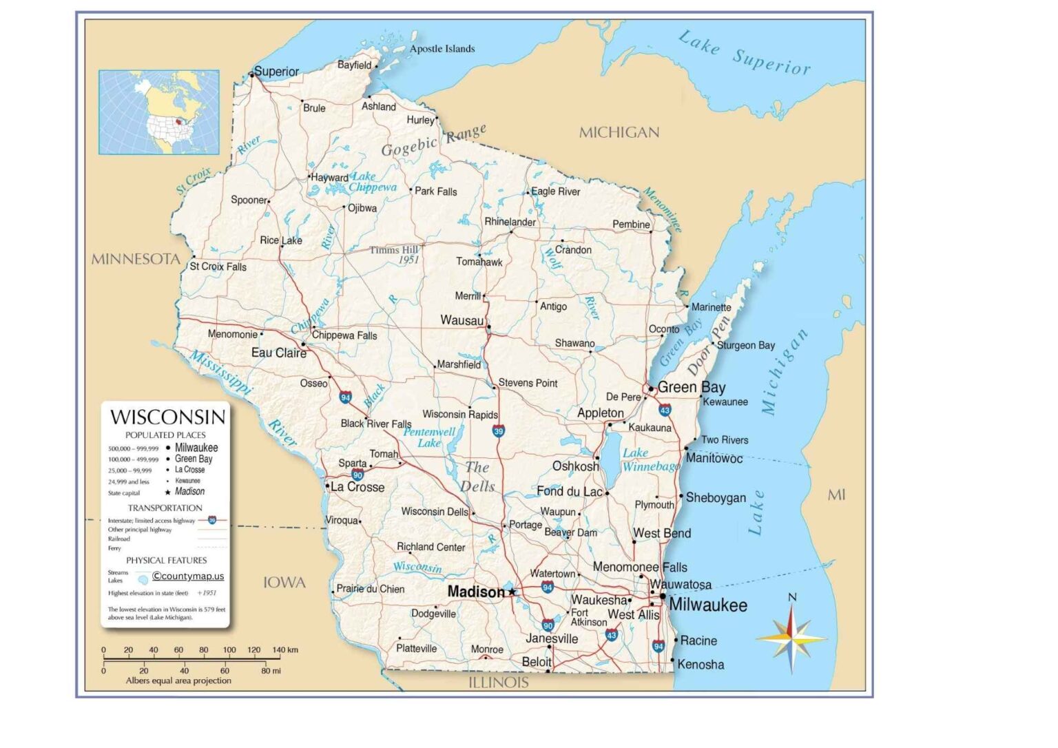
A county map, which indicates the capitals, assists residents, officials, and researchers in the recognition of the centers of local governance and the jurisdictional authority. It also presents a historical outlook, with most of the county seats set up in the 19th century and still forming the midpoint of community activity. These maps are useful and informative in learning about how the civic and administrative structure of Wisconsin works by demonstrating county seats against cities, rivers, highways, and adjoining counties.
Conclusion
Combined with the cities and the capitals in the county maps, the cities and capitals of Wisconsin give the full picture of the geography, population, and governance of the state. The maps with cities are showing the economic, cultural, and educational centers, whereas the maps with capitals are disclosing the administrative centers and historical background.
Together, they provide valuable planning, research, travel, and educational insights due to the level of balance between urban and rural populations and a wide range of economic and cultural diversity within the state.