Loading content...
Texas County Map | TX Counties with Cities
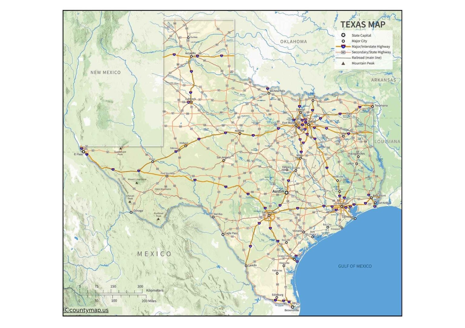
The Texas County Map provides an excellent visual illustration of the counties across the state, including the boundaries, larger cities, highways, and natural features of the counties; it is a useful resource for tourists, students, and planners. The map also shows the county's population, economic centers, and land features, which gives the reader an immediate understanding of the land features of Texas.
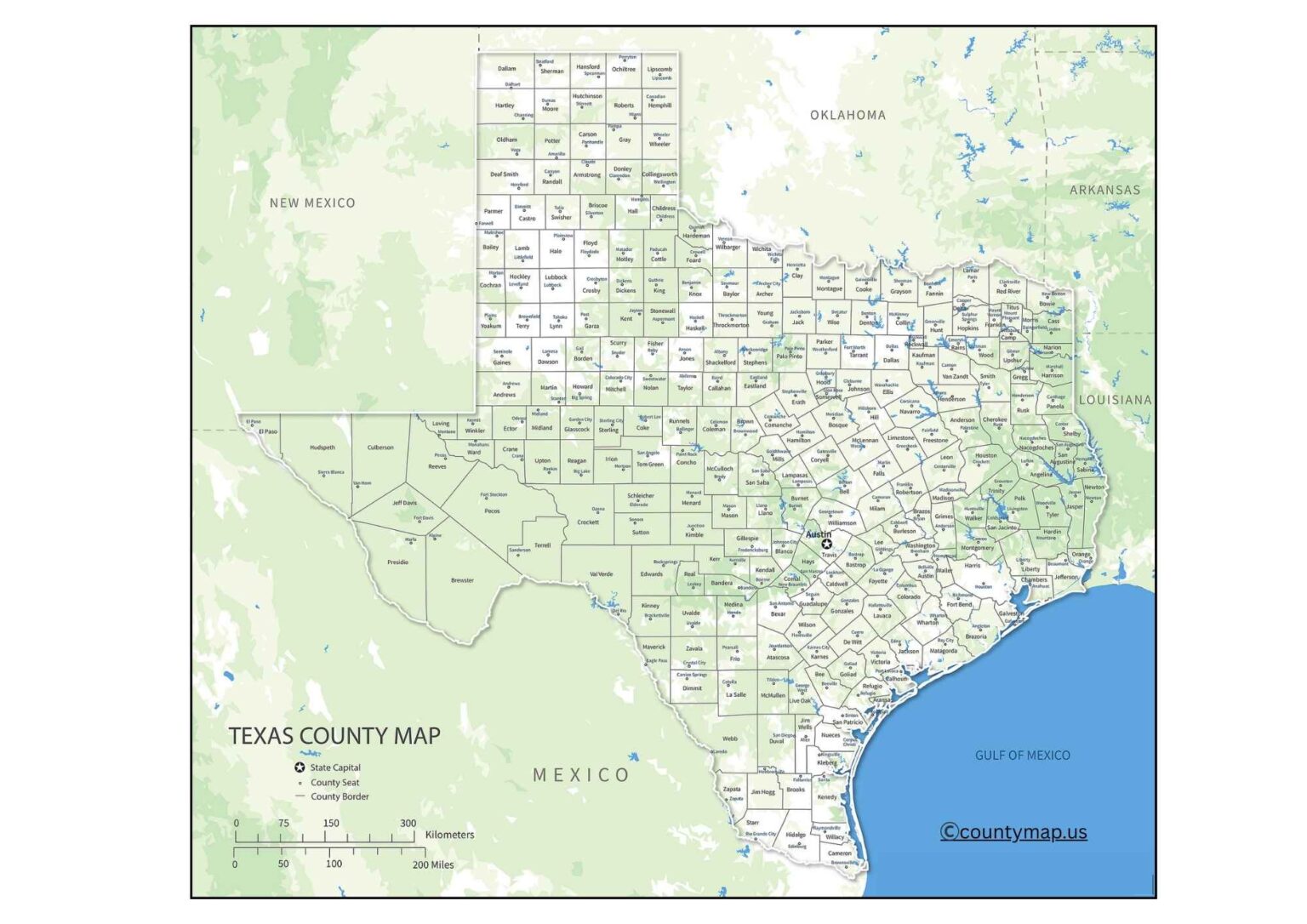
It is a good reference tool for wondering about a Texas road trip, demographic research, Texas geography study, or just wondering about every county's location, population, or size, as well as all of the neighboring counties. Additionally, the Texas County Map can be a good reference for navigation, planning, educational proposals, real estate planning, or decision-making related to business or government. It is easy for anyone to use and will certainly provide the answer for any user to have the information to navigate the counties of Texas with certainty and confidence due to the careful and detail-oriented construction of the map.
Texas County Map with Cities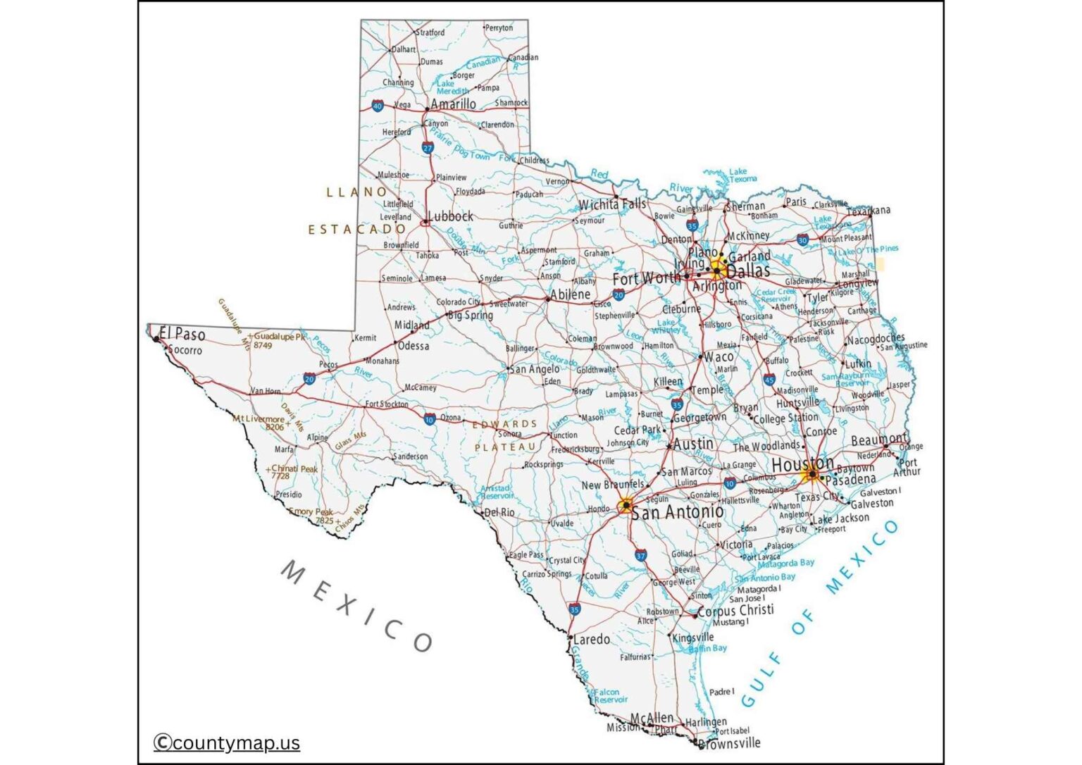
Texas is the second-largest state in the United States, which is partitioned into 254 counties, making it the state with the most counties in the United States. The map of Texas counties with city points out where urban centers, suburban communities, and rural towns have been located in an enormous, geographically diverse state. Big urban centers are Houston (Harris County), the largest city and a global center of energy, business, and culture; Dallas (Dallas County), which is the city of finance, technology, and business; and Austin (Travis County), the capital of the state and the center of government, technology, and culture.
San Antonio (Bexar County) is a mixture of the past and the present, industry and tourism. Fort Worth (Tarrant County), El Paso (El Paso County), Arlington (Tarrant County), and Plano (Collin County) are other major cities that have been known to diversify the economy of the state. Smaller cities that nevertheless play a significant role in the economy include Lubbock (Lubbock County), Amarillo (Randall County), and Odessa (Ector County), which uphold agriculture, energy, and regional trade.
The eastern parts of Texas, such as Jefferson, Tyler, and Nacogdoches, have towns with industrial and cultural significance, whereas the western part, such as Midland and Pecos, is concentrated on oil, gas, and ranching. CoA County, including cities, provides a visual perception of how population is distributed, economic centers, and connectivity of the regions, and the way through which cities, suburbs, and rural regions interact to form the dynamic and diverse terrain that is Texas.
Texas County Map with Capital
On a county map of Texas, the capitals of the counties are highlighted, where the administrative centers of the local government, courts, and other services are concentrated. All of the 254 counties of Texas have a county seat, which can be considered the seat of government, trade, and commerce, as well as a communal center. The state capital, where the governor has his office, the legislature, and the main state institutions are located, is Austin, the capital of Travis County. Houston (Harris County), Dallas (Dallas County), and San Antonio (Bexar County) are other large county seats and are both administrative, economic, and cultural hubs.
There are numerous smaller county seats, like Lufkin (Angelina County), Cleburne (Johnson County), and Brownwood (Brown County), which offer necessary governmental and judicial services to the local people. County seats in the west, such as Midland (Midland County) and Pecos (Culberson County), are responsible for the energy industries as well as local governance, whereas those in the eastern parts, such as Beaumont (Jefferson County) and Tyler (Smith County), have the job of handling industrial, cultural, and administrative matters.
The map shows the geographic dispersion of centers of governance through the vast and diverse Texas landscape and how the administrative functions are accessible both in the densely populated regions and in the rural ones. The county map, including capitals, is very important in comprehending the local administration, the court functioning, and the distribution of the service in the region, with the emphasis on the proportion between urban centers and small administration towns in the whole state.
Conclusion
The Texas county maps, whether in terms of cities or capitals, offer very important insights about the geography, economy, and governance of the state. City maps identify key urban centers such as Houston, Dallas, Austin, and San Antonio, as well as smaller urban centers that are of great importance in agriculture, energy, and local trade. County seat maps highlight the centres of administration, and they indicate the distribution of governance and services available to the people, both in the urban centres and rural areas.
Combined, these maps demonstrate how Texas is a land of immense dimensions with a wide range of diversity, revealing the relationships between the urban development, the local governments, and the connectivity in the region. They are indispensable resources for residents, planners, and researchers who want to have a comprehensive picture of the state.