Loading content...
Vermont County Map | VT Counties with Cities
The Vermont County Map is an instructive tool that allows one to have a clear picture of the administrative sub-units and the geography of the state. Vermont is a state of picturesque landscapes, rolling hills, and small towns, which has 14 counties, each with its own peculiarities and local culture. The county map is quite detailed, indicating the largest cities, towns, rivers, roads, and other natural features, which is why it is useful to residents, travellers, educators, and researchers.
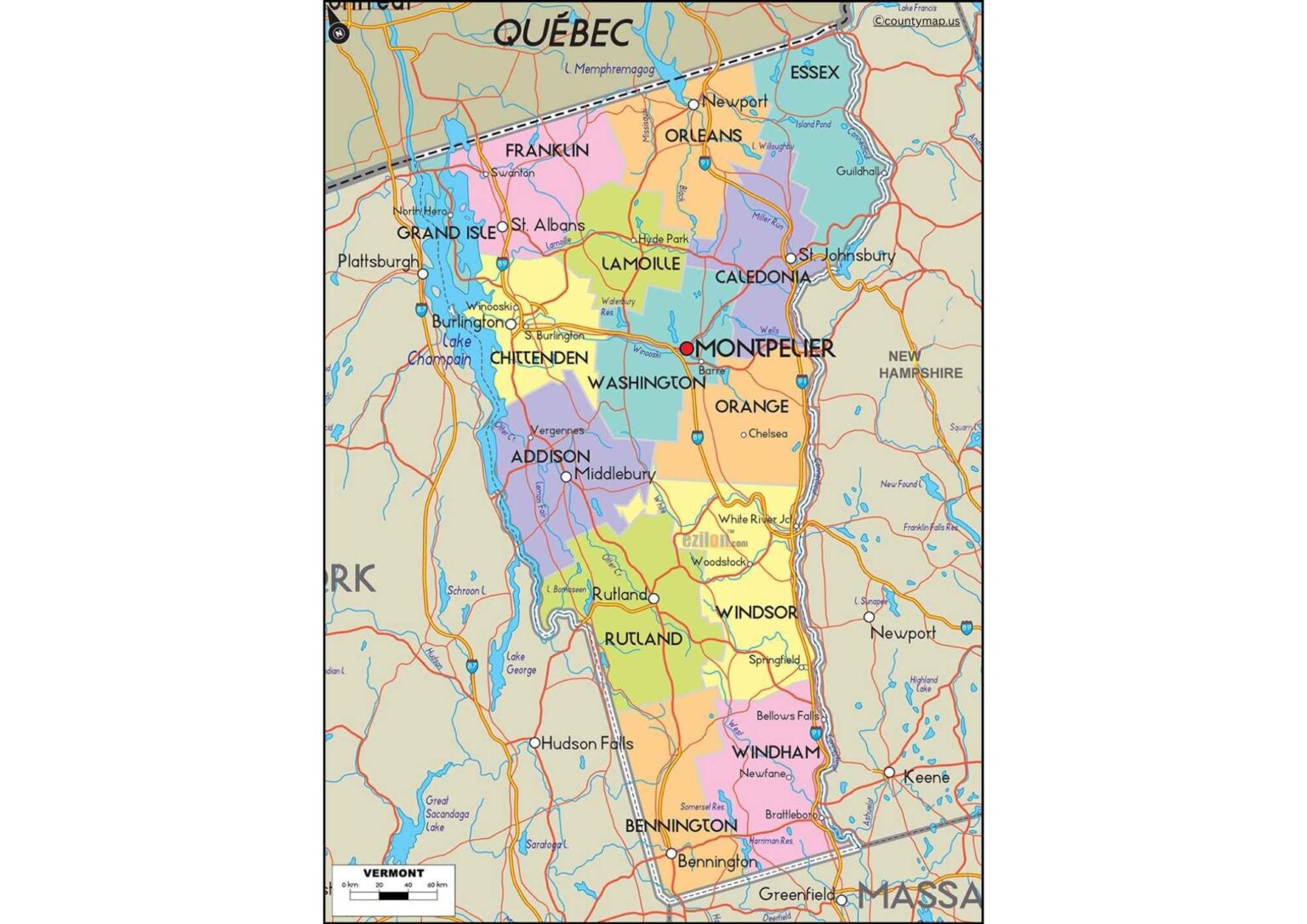
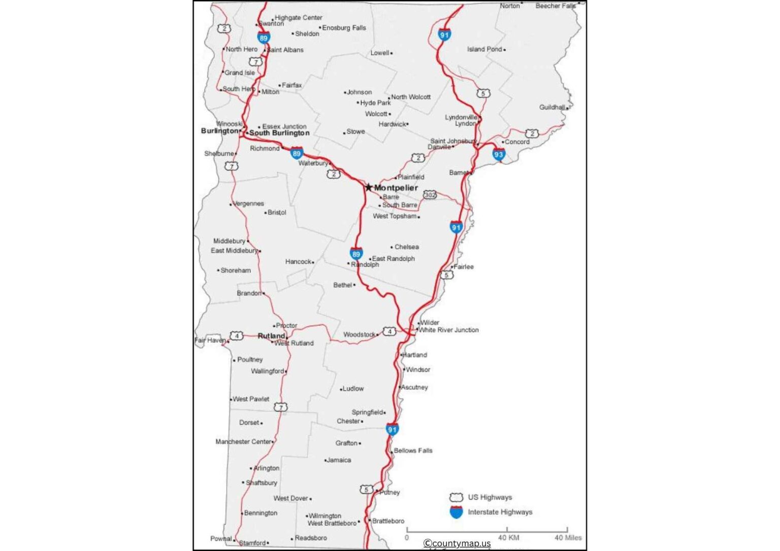
It is a vital resource when planning road excursions, learning the history of the region, demographic information, or an interpretation of economic and social formations throughout the state. The map also uses the county seats and key transportation routes as a way of providing information about the connectivity and infrastructure of Vermont. Regardless of the academic use, tourists planning, or local governance, the Vermont County Map offers a wholesome view of the organisation and geography of the state, and therefore, users can navigate and take a tour of Vermont easily and accurately.
Vermont County Map with Cities
Vermont County Map with Cities: It is a detailed map of all 14 counties of Vermont, and through this map, you can use and explain urban areas, population, and the surrounding nature of Vermont.. Vermont is one of the northeastern states of the U.S., in New England, and is famous for its beautiful scenery, rolling hills, mountains, and quaint towns. The large cities of the state are in the major counties: Chittenden, Rutland, Windsor, and Washington. Burlington, Vermont's largest city and home to the University of Vermont and a centre for commerce, education, and culture, lies in Chittenden County. Rutland City is also Rutland County's regional centre for trade, tourism, and transportation.
Windsor County has towns such as Woodstock and Springfield, which are well known for their history and tourism. The county encompasses Montpelier, the state capital and a cultural and governmental hub. Smaller towns with local charm and historic landmarks can be seen in other counties such as Addison, Bennington, and Windham. Vermont Population Distribution Among the Counties of the Connecticut Valley River Basin.
A county map with cities represents the link between towns, rivers, and natural features that we want to show how the inhabitants of Vermont are distributed across the state and around economic activities. These types of maps have applications for travellers, researchers, educators, and businesses in terms of understanding regional trends, economic centres, and recreational opportunities. A Vermont county map with towns not only tells you where the major cities are located but also the smaller towns that showcase urban vs rural life, cultural heritage, and economic activity across the Green Mountain State.
Vermont County Map with Capital
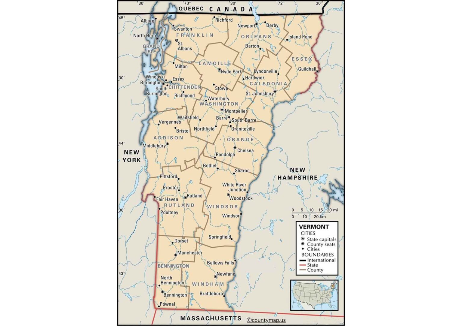
There is also a Vermont county map with the capital that identifies the capital of each of the counties in this state, which consists of 14 counties. Building Blocks: County Capitals County capitals are local hubs of government, judiciary, and public services. Montpelier is certainly the seat of Washington County and also the capital of Vermont, the political and administrative heart(not the geographic heart, though, because that would be a different theme, I suppose) of the state. While Burlington is the largest city in Chittenden County, it is in fact the county seat and is one of the largest economic and educational centres in the region.
As the Rutland County seat, Rutland houses government offices and civic institutions. Middlebury (Addison County), Bennington (Bennington County), and Brattleboro (Windham County) are other county seats that maintain historical and administrative significance. While usually smaller than the largest cities in the state, these county capitals are important for governance, often housing courthouses, municipal offices, and public services for their counties. County maps that also include the location of the capital of counties are useful for the people, officials, and visitors as they highlight where administrative and civic functions are found.
They place the material in historical context, demonstrating how towns founded in the 18th and 19th centuries continue to influence Vermont’s political and civic structure. Such maps provide another useful and educational way to understand how government works in Vermont — its structure and regions — by showing county seats in relation to towns, rivers, and transport networks.
Conclusion
The county maps for Vermont that include cities and capitals together provide ample information about the essence of the state. Maps centred around cities reflect populations, trade, and education, while capital-geared maps strengthen the administrative heartland and history. Together, they cover the needs of planning, research, travel, and education, representing Vermont’s mix of rural areas, urban centres, and civic organisations.