Loading content...
USA Labeled Map with States Capitals Cities
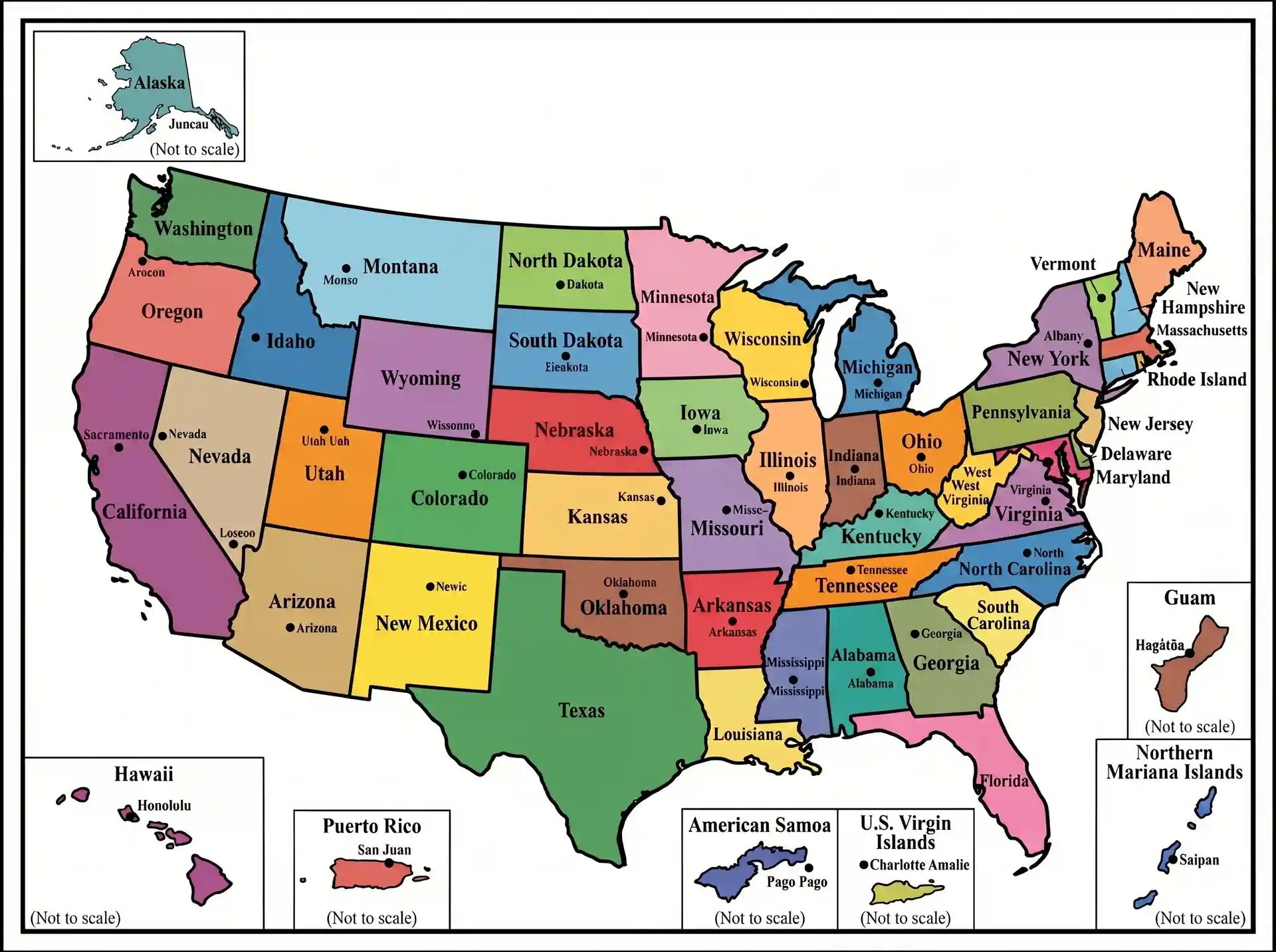
The USA Labeled Map is an informative and detailed map of the country that clearly shows all the 50 states, their capitals, and in many cases big cities and geographic regions. It is formulated in such a way that learning and reference are made easy, as the correct names and locations are given in a visually structured format. These maps are also common in classrooms, offices, and students can use them to study on their own, with the ability to easily locate states such as California, Texas, and New York, and their location with respect to each other. A labeled map is particularly helpful to beginners because it eliminates the guesswork and promotes quicker memorization of geographic information. Educational, travel planning, or general knowledge, a USA-labeled map is an in-depth, easy-to-read visual representation of the structure of the country.
Printable Labeled USA Labeled Map PDF
| Map Feature | Details |
| Map Type | Labeled Map |
| Coverage | All States & D.C. |
| Labels | States, Capitals, Cities, Rivers |
| Format | Printable PDF |
| Usage | Education, Travel, Research |
| Resolution | High Quality |
| Access | Free Download |
FREE USA Labeled Map
A Free USA Labeled Map is a clear map of all the 50 states and their capitals, and in most cases, of major cities, making it a very good learning and reference tool. It assists users in finding places like California, Florida, and New York fast and with precise labels and boundaries. These maps are easily accessible on the internet in high resolution and printable versions and thus are suitable for classrooms, assignments, and individual research. Free labeled maps are more time-saving because they are ready to use, and students and travelers learn about the structure of the United States without any difficulties.
You May Also Like:
Conclusion
The USA Labeled Map is essential for learning state names, capitals, and geographic features. Printable maps allow students, travelers, and researchers to reference information quickly. Geography and seasonal changes provide context for human activity and natural features. Overall, it is a comprehensive tool for education, travel planning, and geographic awareness of the United States.

Jacqueline Y.
New Jersey, USA
I'm Jacqueline, a creator from New Jersey who enjoys simplifying geography, mapping concepts, and community learning. This article helps students, teachers, travelers, and explorers understand local maps easily.
Latest Maps
View All →