Loading content...
USA Political Map with States Capitals Borders
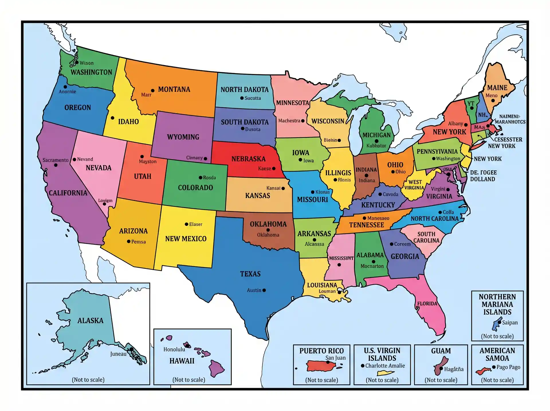
The USA political map gives a clear and orderly picture of the administrative divisions of the country and contains all 50 states, their boundaries, and capitals. It emphasizes the way the country is politically structured and not the physical characteristics of the country, such as mountains or rivers. These maps are vital to students, teachers, and professionals who require a swift grasp of the locations of the states, areas around them, and their significant cities. They are also usually labeled, color-coded, and have significant points of reference that simplify learning and navigation. The political map of the United States is popular to be used in the classroom, presentations, and research works, and it is easy to understand the layout of the country at the first sight. It is an efficient and convenient tool for learning the political geography of the country in a clear and graphical manner, whether one aims to study it academically, plan a trip to the country, or just to know more and more about the country.
Printable Labeled USA Political Map PDF
| Map Feature | Details |
| Map Type | Political Map |
| Coverage | All States & Capitals |
| Labels | States, Capitals, Major Cities |
| Format | Printable PDF |
| Usage | Education, Research, Planning |
| Resolution | High Quality |
| Access | Free Download |
FREE USA Political Map
The Free USA Political Map has the boundaries of all the 50 states, major cities and capitals clearly and it is therefore ideal both in education and in references. It emphasizes the names of states, their boundaries and tends to add major geographical features to enhance comprehension. Students, teachers, and travelers also use these maps extensively to learn the political boundaries of the country. Printable versions can be easily downloaded online in high resolution to be used in classrooms or to be studied personally. There are also many free labeled and blank maps, which allow the user to practice and develop geography skills or make their own learning resources efficiently.
You May Also Like:
Conclusion
The USA Political Map provides a clear understanding of the country’s political boundaries and capitals. Printable maps allow students, researchers, and travelers to study state divisions and regional governance. Seasonal variations, urban development, and population distribution are influenced by geography. This map is essential for learning about political structures, planning travel, or understanding election regions. Overall, it’s a practical tool for education, research, and civic awareness in the United States.

Jacqueline Y.
New Jersey, USA
I'm Jacqueline, a creator from New Jersey who enjoys simplifying geography, mapping concepts, and community learning. This article helps students, teachers, travelers, and explorers understand local maps easily.
Latest Maps
View All →