Loading content...
USA Outline Map Printable Blank Borders Download
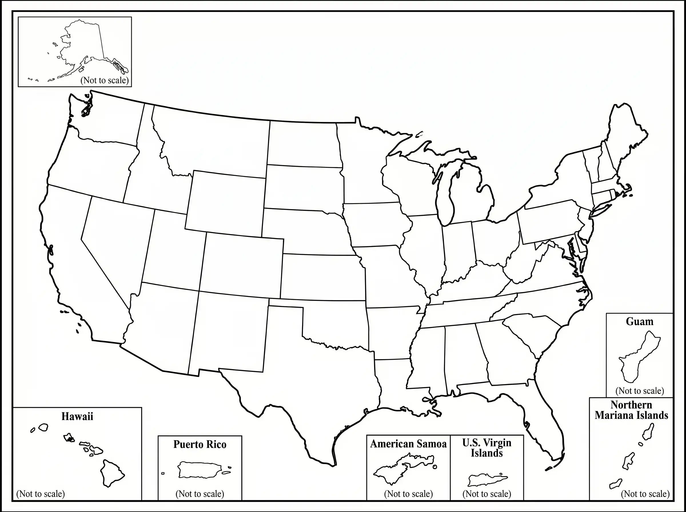
The USA Outline Map is a plain, generalized map of the country, which illustrates its external limits and in most instances, the borders within the state without elaborate labels and geographic characteristics. The clean format of this makes it a perfect resource to use in educational activities where students can be allowed to practice on labeling all the 50 states, capitals, and major regions on their own. Quizzes, assignments, and the interactive learning activities that develop the geographic knowledge are often organized with outline maps used by teachers. They can also be used in presentations, planning, and creative projects that require customization. A USA outline map, whether in printed or digital formats, is a blank canvas onto which information can be added, like population data, climatic zones, or travel routes. Its simplicity promotes active learning and allows users to learn the layout of the country better, in an interesting, adaptable manner.
Printable USA Outline Map PDF
| Map Feature | Details |
| Map Type | Outline Map |
| Coverage | All States & D.C. |
| Labels | State Borders Only |
| Format | Printable PDF |
| Usage | Education, Practice, Learning |
| Resolution | High Quality |
| Access | Free Download |
FREE USA Outline Map
A Free USA outline map is a clear and simple map of the USA, unlabeled and uncluttered, which indicates state borders without any additional information. It is ideal and suitable for students, teachers, and any person who wants to study the geography of the U.S., as it enables one to practice marking all the 50 states, capitals, and regions. These maps can be found in large sizes with high resolutions and in printable formats all over the internet and can be used in the classroom setting, for quizzes, and at home. They could also be used in projects such as data mapping, coloring, or traveling. Free outline maps are easy, adaptable, and very helpful in creating a clear perspective of the layout of the United States.
You May Also Like:
Conclusion
The USA Outline Map is an essential tool for learning state shapes and national boundaries. Printable maps allow students and educators to practice labeling and geographic exercises. Seasonal and geographic variations enhance understanding of the country’s regions. This map is simple, clear, and ideal for education, quizzes, and geography lessons, helping learners visualize the United States’ structure.

Jacqueline Y.
New Jersey, USA
I'm Jacqueline, a creator from New Jersey who enjoys simplifying geography, mapping concepts, and community learning. This article helps students, teachers, travelers, and explorers understand local maps easily.
Latest Maps
View All →


