Loading content...
USA Physical Map Mountains Rivers Terrain View
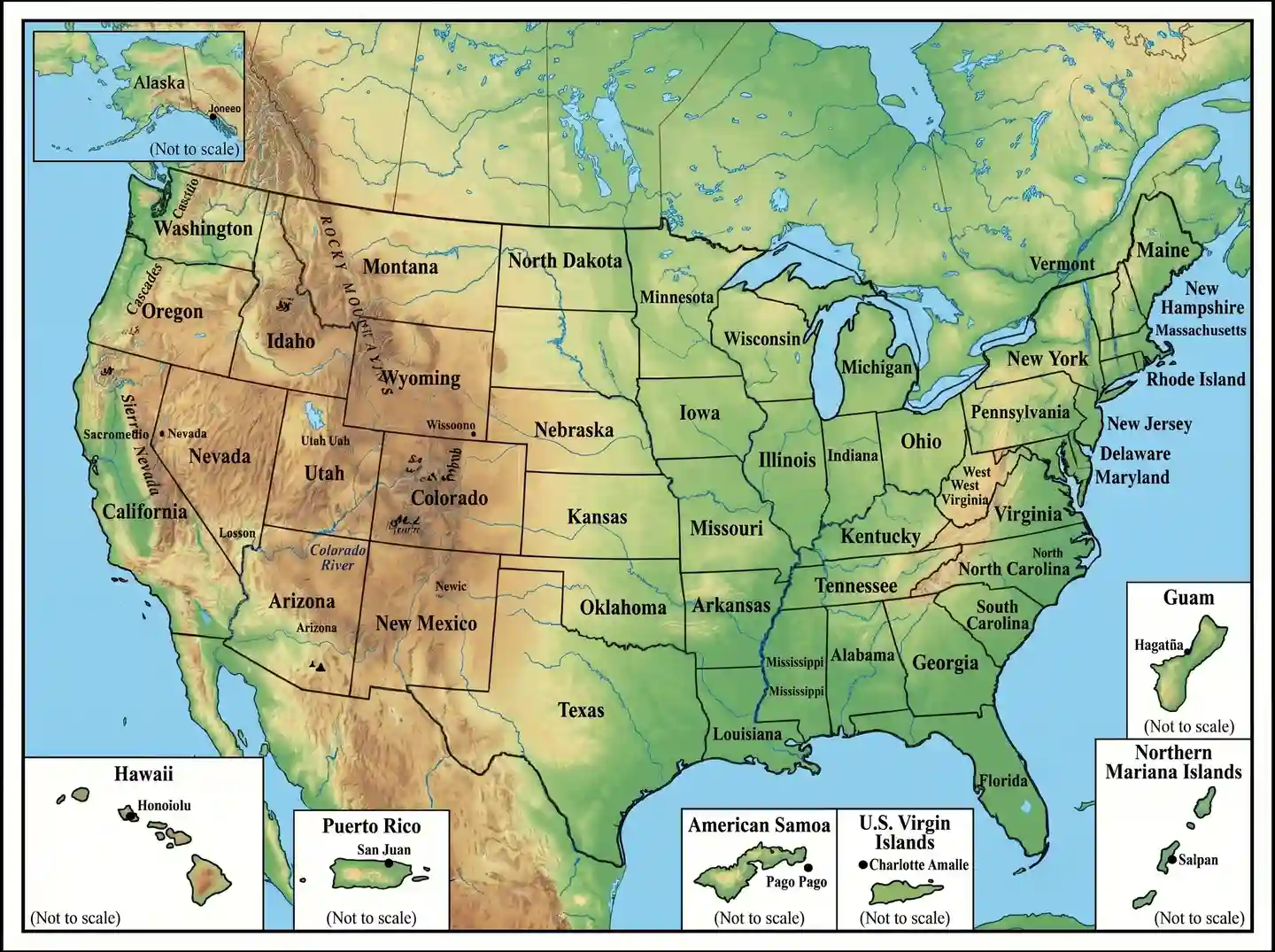
A USA Physical Map is a detailed map of the natural landscape of the country, depicting the country in terms of mountains, rivers, plains, deserts, and coastline. In contrast to political maps, it centers on geography that is formed by nature and allows the users to have an idea of the area and altitude in various areas. Large landmarks such as the Rocky Mountains, the Mississippi River, and the Great Plains are well depicted, and in most cases, there is a color gradient to depict the height and depth. The maps can be useful to students, travelers, and researchers who desire to understand the effect of the physical geography on climate, wildlife, and human activities. The USA physical map facilitates easier visualization of the various landscapes, from rugged highlands to flat lowlands, that give a complete picture of the natural landscape of the country in a simple, engaging, and informative format.
Printable Labeled USA Physical Map PDF
| Map Feature | Details |
| Map Type | Physical Map |
| Coverage | Nationwide |
| Labels | Mountains, Rivers, Lakes, Deserts |
| Format | Printable PDF |
| Usage | Education, Travel, Research |
| Resolution | High Quality |
| Access | Free Download |
FREE USA Physical Map
A Free USA Physical Map presents the natural features of the country (mountains, rivers, deserts, and plains) in a clear and easy-to-understand format. It brings to the forefront the significant features such as the Rocky Mountains, the Mississippi River, and the Great Lakes, with color shading frequently showing height and topography. The maps are ideal for students, teachers, and geography lovers who want to learn the topography of the country. They are free to download, in high-quality, printable versions, and are therefore perfect in classrooms, as a study aid or as a personal reference at no cost.
You May Also Like:
Conclusion
The USA Physical Map is vital for understanding the country’s natural features. Printable maps help students, researchers, and travelers visualize mountains, rivers, lakes, and plains. Seasonal changes, climate, and geography impact ecosystems and human activity. Overall, this map provides a detailed view of the United States’ terrain, supporting education, travel planning, and environmental awareness.

Jacqueline Y.
New Jersey, USA
I'm Jacqueline, a creator from New Jersey who enjoys simplifying geography, mapping concepts, and community learning. This article helps students, teachers, travelers, and explorers understand local maps easily.
Latest Maps
View All →